Summit Day: Finally Meeting Mama K!

Seamane and I woke up a bit before 5 o’clock this morning. I think we were both awake ahead of our alarms, not because of the excitement of the day but rather because neither of us was particularly comfortable stuffed into the back of a mid-sized SUV. We had flopped around a lot but somehow managed to get some sleep, though. I think both of us were so emotionally worn out from the buildup ahead of seeing each other that we eventually passed out.
It was still well before dawn, so we kind of fumbled around in the dark trying to get ourselves ready to head to the summit of Katahdin. We were trying to be mindful of not waking up anyone around us who wasn’t ready to get up yet, but our rental car kept lighting up like the spaceship from Close Encounters of the Third Kind, so it was kind of a futile effort.
We shoved a bunch of donuts in our faces, and S. chugged a canned Starbucks coffee while I had a protein smoothie. Neither one of us was particularly hungry, but we knew we’d need the calories. S. had gotten us a couple of Red Bulls for the day, just in case, so I put them in my pack. I left most of my stuff in the car, though, and just brought the basics we’d need for the day, like water and snacks, some first aid supplies, my Garmin, of course, and our coats in case it was cold or started raining above the treeline.
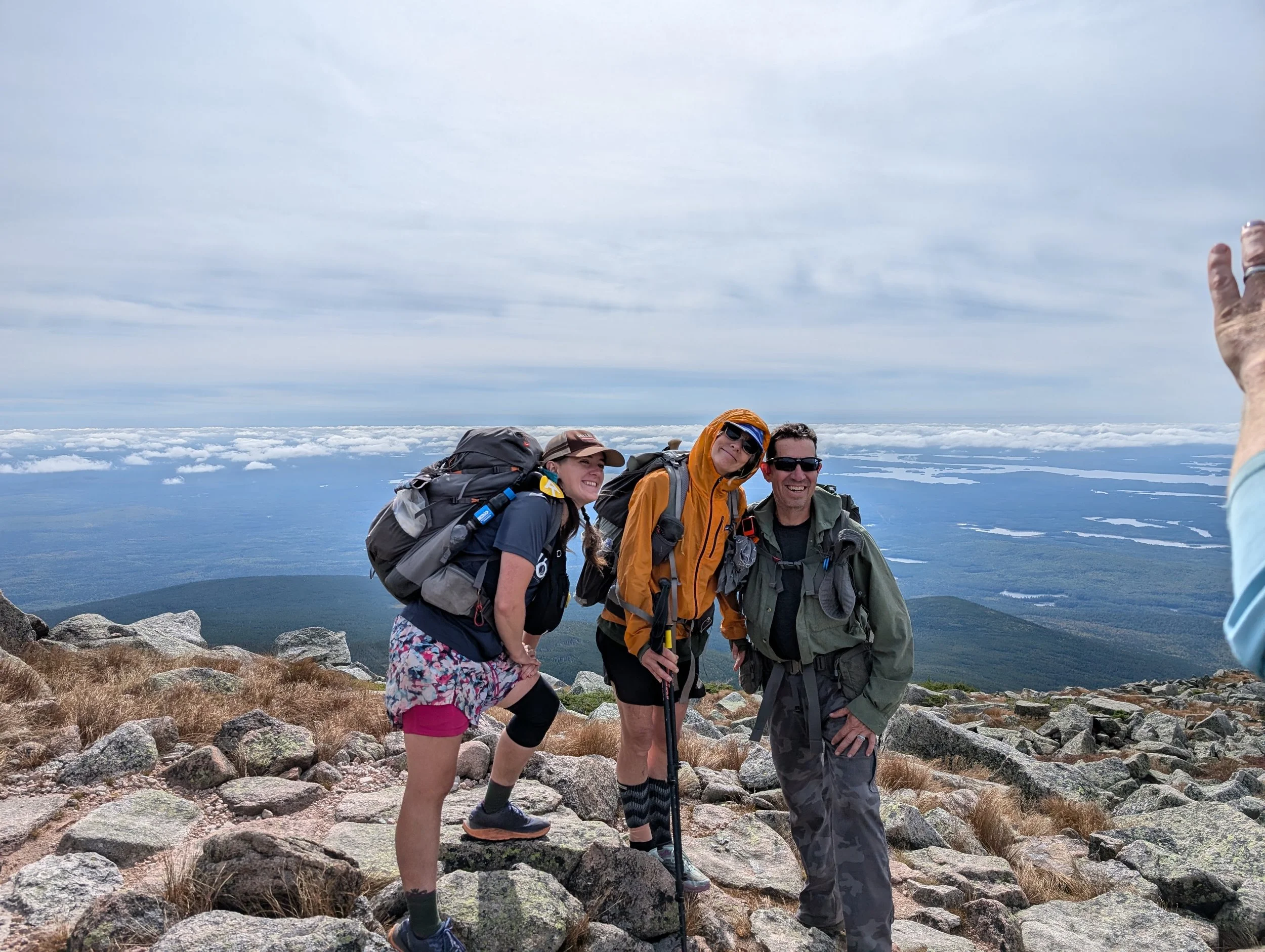
Not Yet was up and out of camp by 5:30. He just kind of disappeared. We could hear Munich Mule moving around, but no one was really talking. Carolina Sunshine and Salamander showed up just before 6 o’clock, and before we headed out with them, S. took the rest of the donuts and some other snacks and coffee over to Groovy and Half Boot, who had stayed at the campsite next door to us.
Salamander and Carolina Sunshine had both taken most of the stuff out of their backpacks, too, so we were all traveling light for the day. Salamander had stuffed her quilt into hers, though, so it would look full in her summit pics without being heavy.
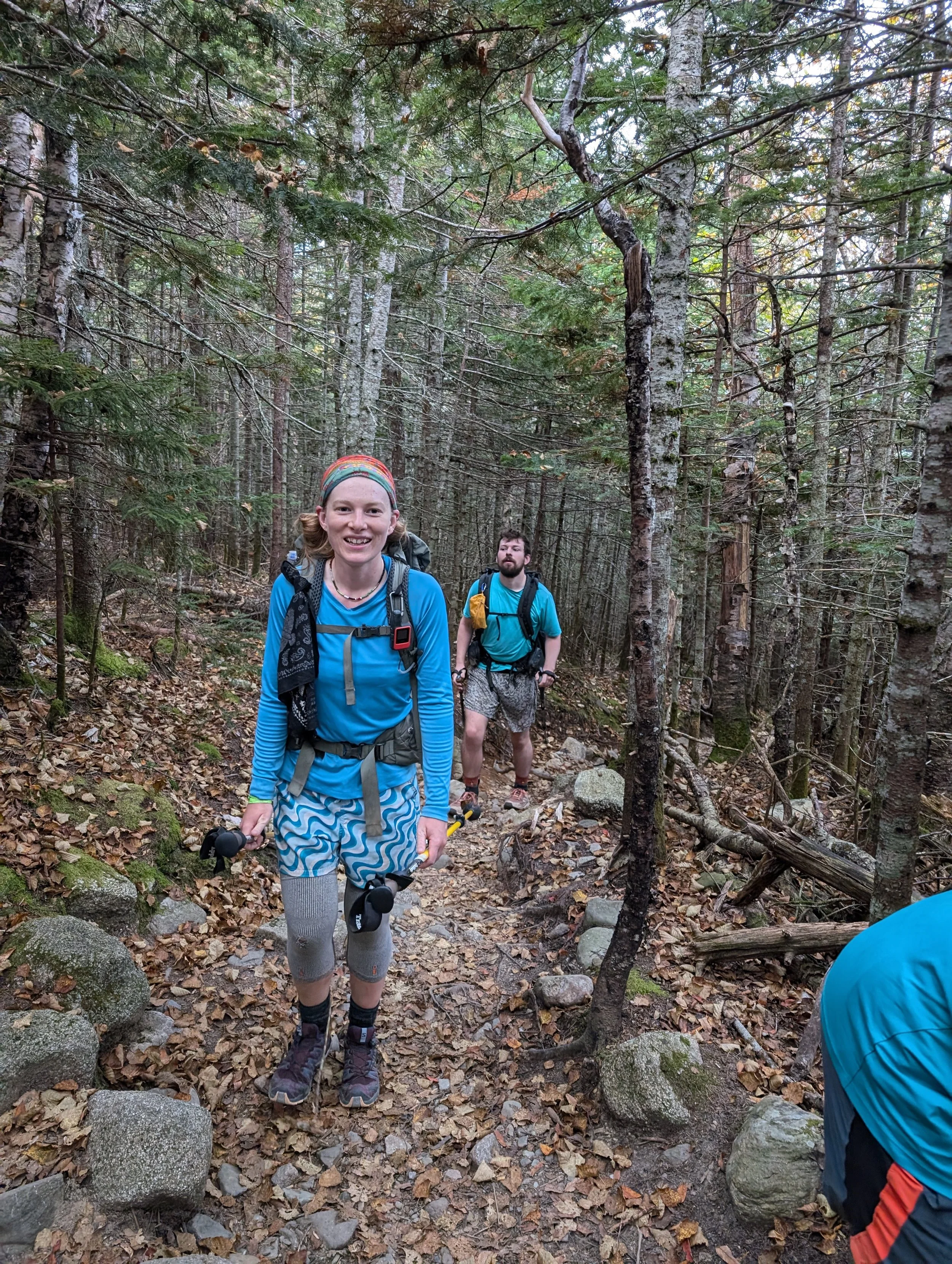
We started up the Hunt Trail, which represents the final 5.2 miles of the Appalachian Trail for NOBO hikers. S. had watched about 500 hours of YouTube videos ahead of the hike so she could feel prepared for what lay ahead, which translated into her knowing much more about what we were about to encounter than any of the rest of us did.
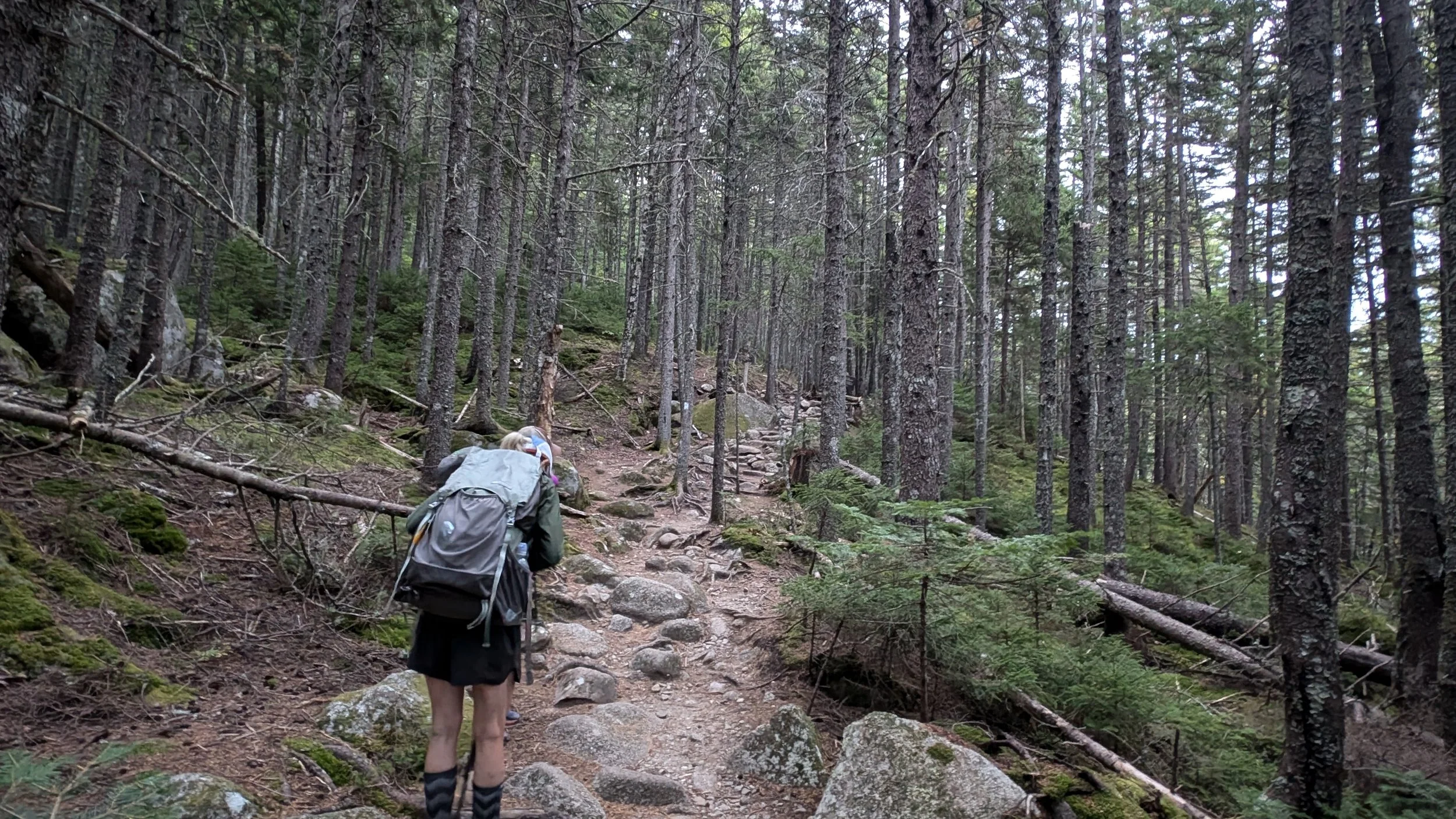
The trail ascends about 4,000 feet over the remaining miles, which is pretty steep. Any time the trail gains more than 700 feet in a mile, you know you’re in for a climb. Anything above 1,000 feet in a mile is ridiculous. And things started out fairly mild, so we knew we were definitely going to hit some 1,000-feet-of-elevation-per-mile territory.
The trail was a bit rocky to start, but not too bad. We passed Katahdin Stream Falls almost right away, and Salamander and Carolina Sunshine stopped to take some pics.


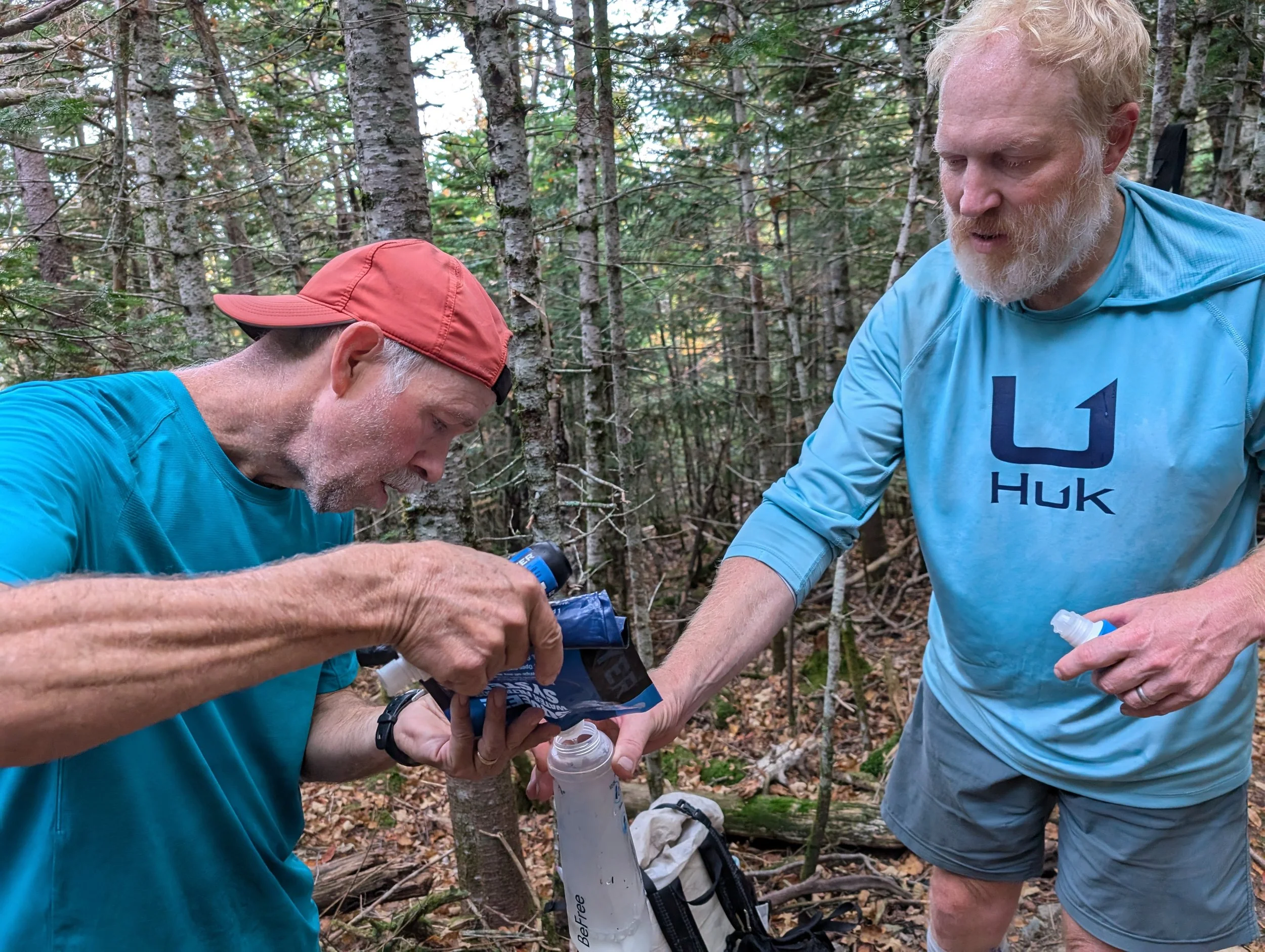
Not long after that, we hit the last good place to get water on the way up, so we all took the opportunity to top up our water bottles.

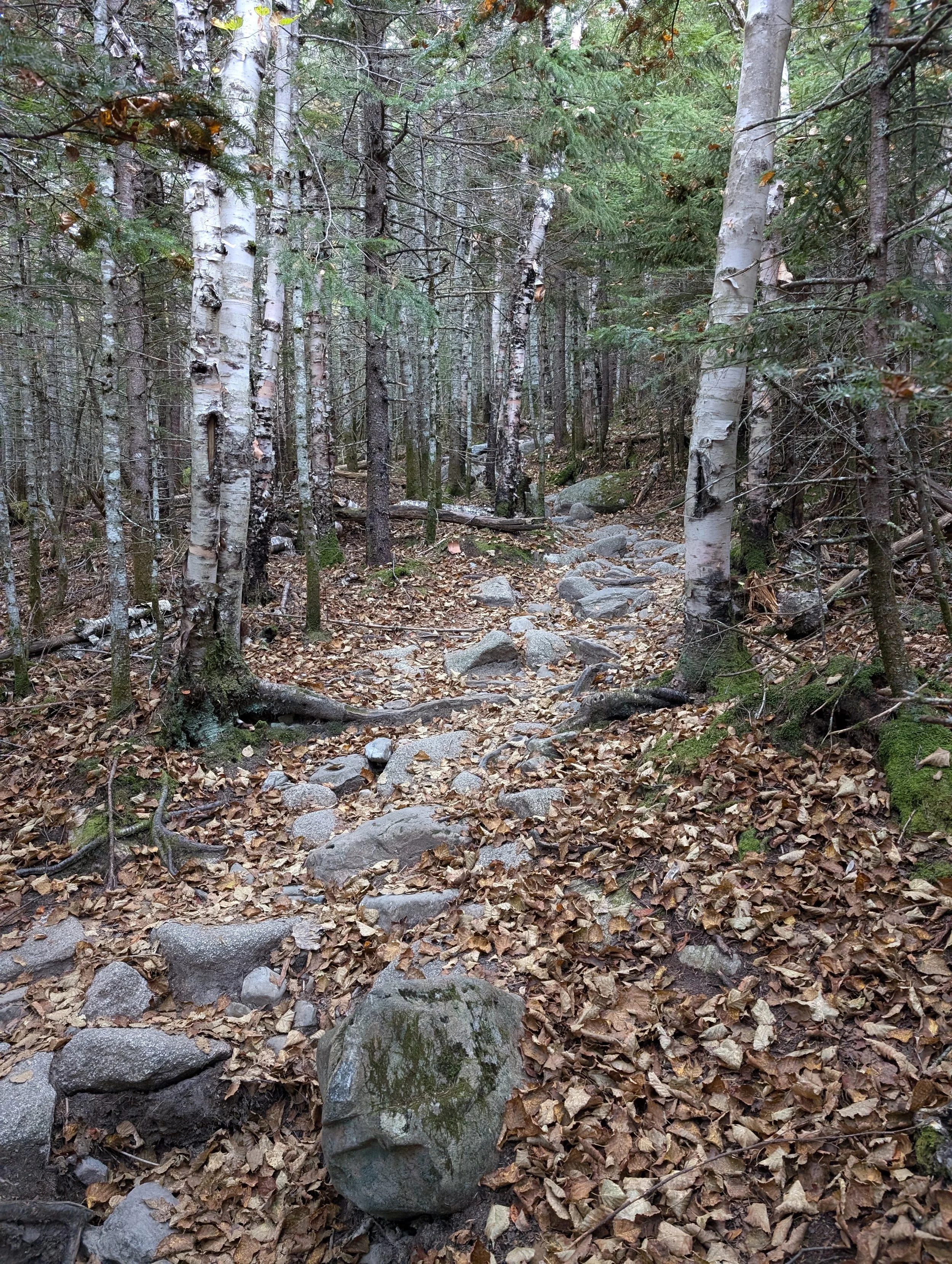
It got progressively more steep from there and was pretty muddy here and there. We had to grab on to roots and trees to pull ourselves up in some spots. S. remarked that you could tell which trees you needed to hold on to by looking for the ones that were all shiny from people’s hands.

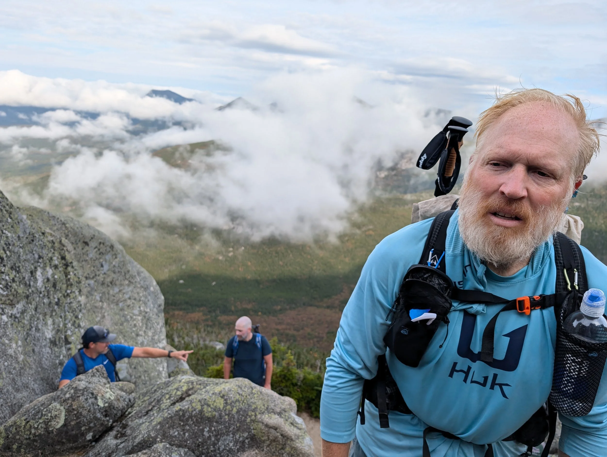
Groovy and Half Boot caught up to us fairly early on, and from there, the two of them led the way for our little group. Munich Mule caught up to us, too, but he just charged ahead and kept going. He wasn't about to slow down. And when he hikes, he looks like he’s putting no effort into it whatsoever. He just kind of glides along. It’s impressive. We also got passed by FIIK and Sundial, who were making good time as well.
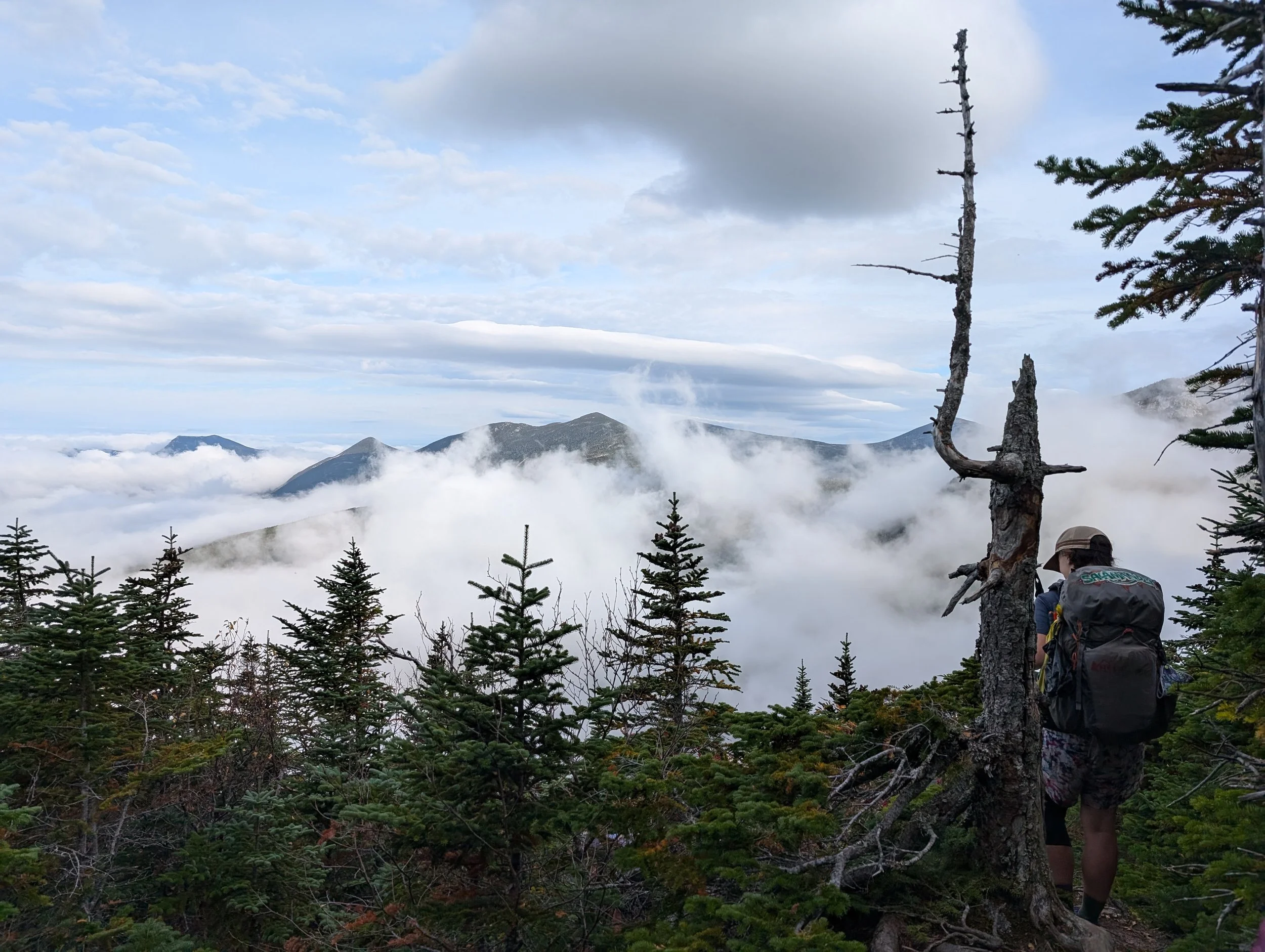
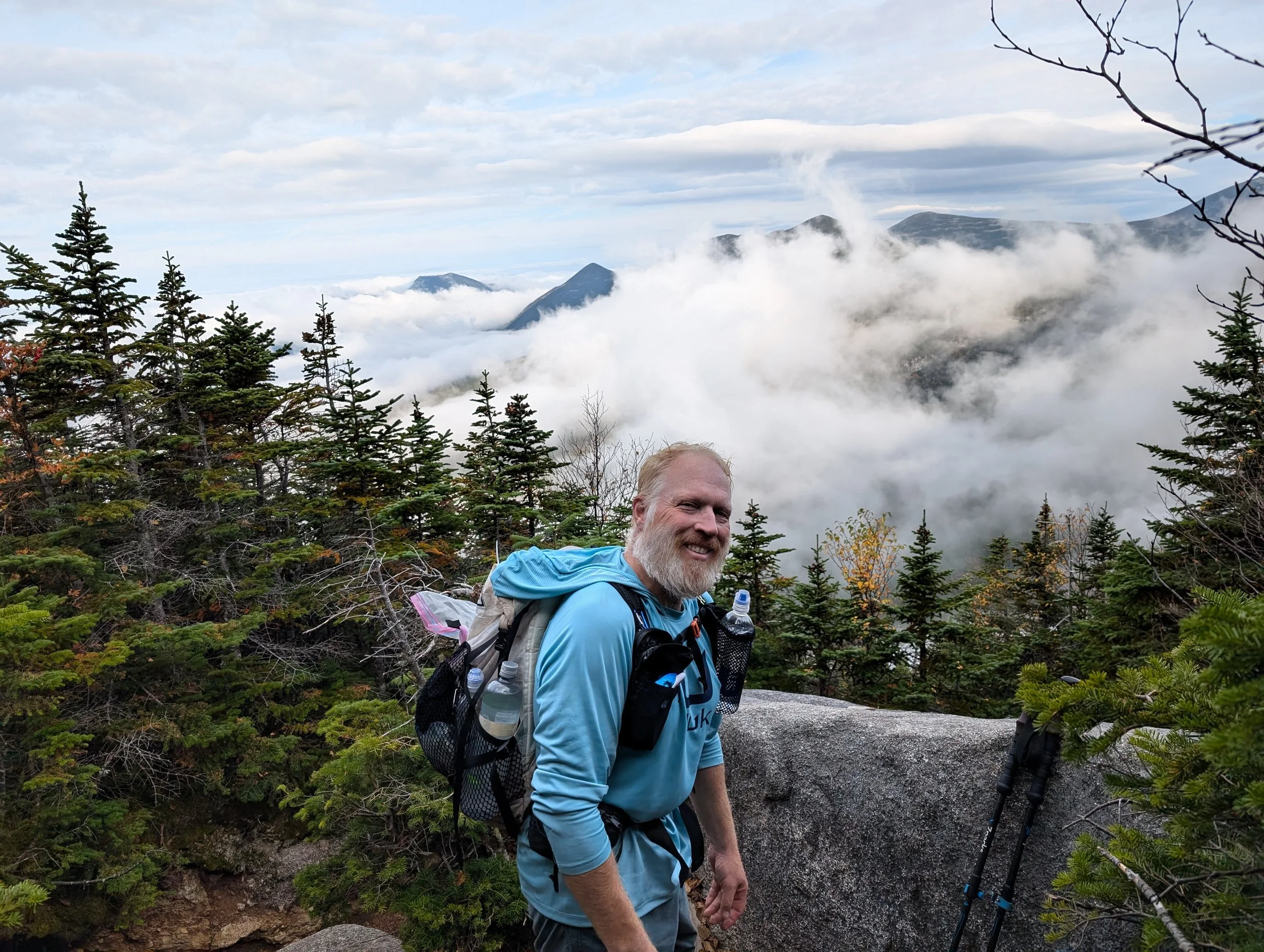
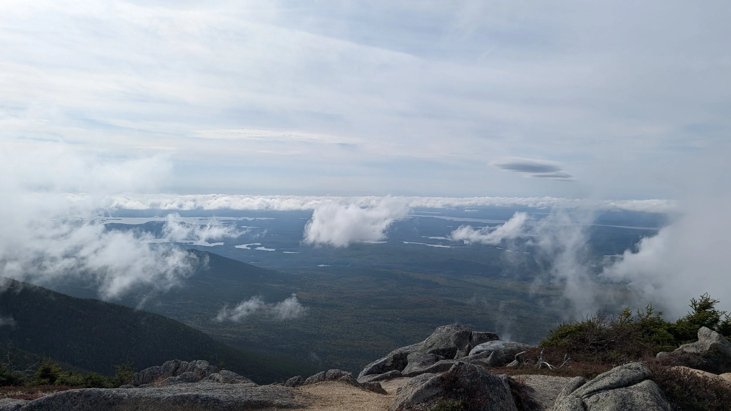
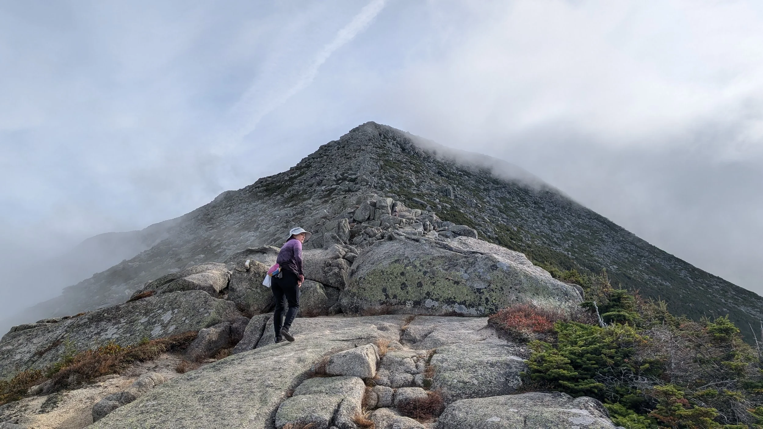
The weather was fantastic — which we were all really grateful for — and we were treated to some excellent views fairly early, especially once we hit the tree line. And as we got higher up, the morning clouds started burning off, which gave us a spectacular view of the 100 Mile Wilderness we’d just crossed to get here. The trail continued to steadily get more and more challenging, and the “hike” sort of morphed into a "climb.”


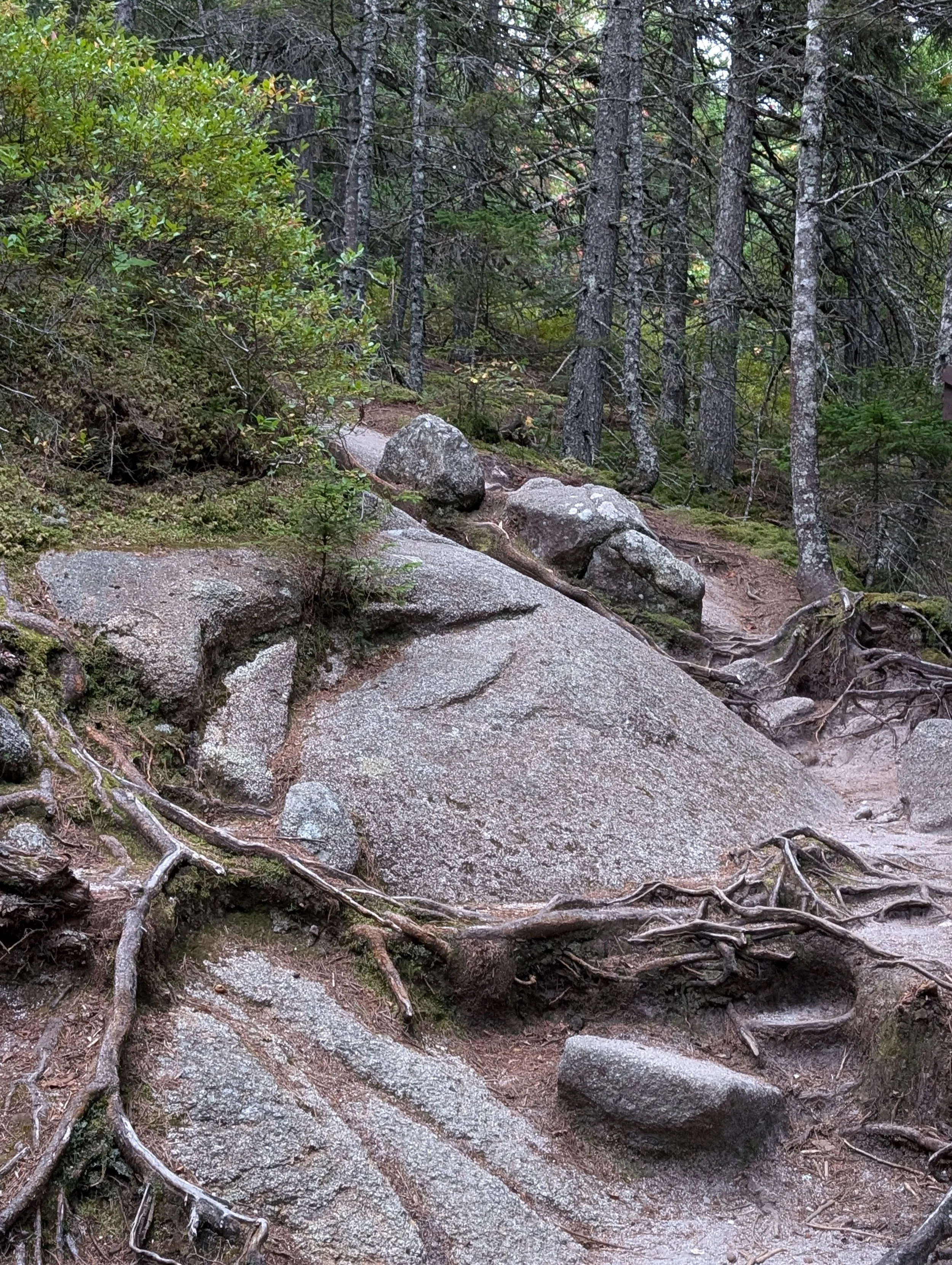
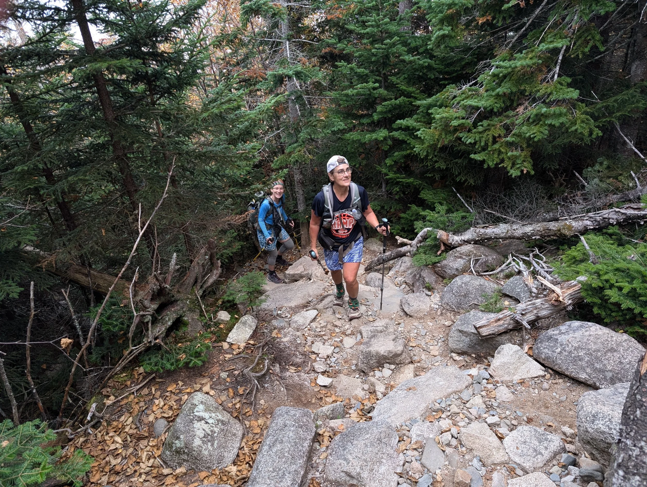
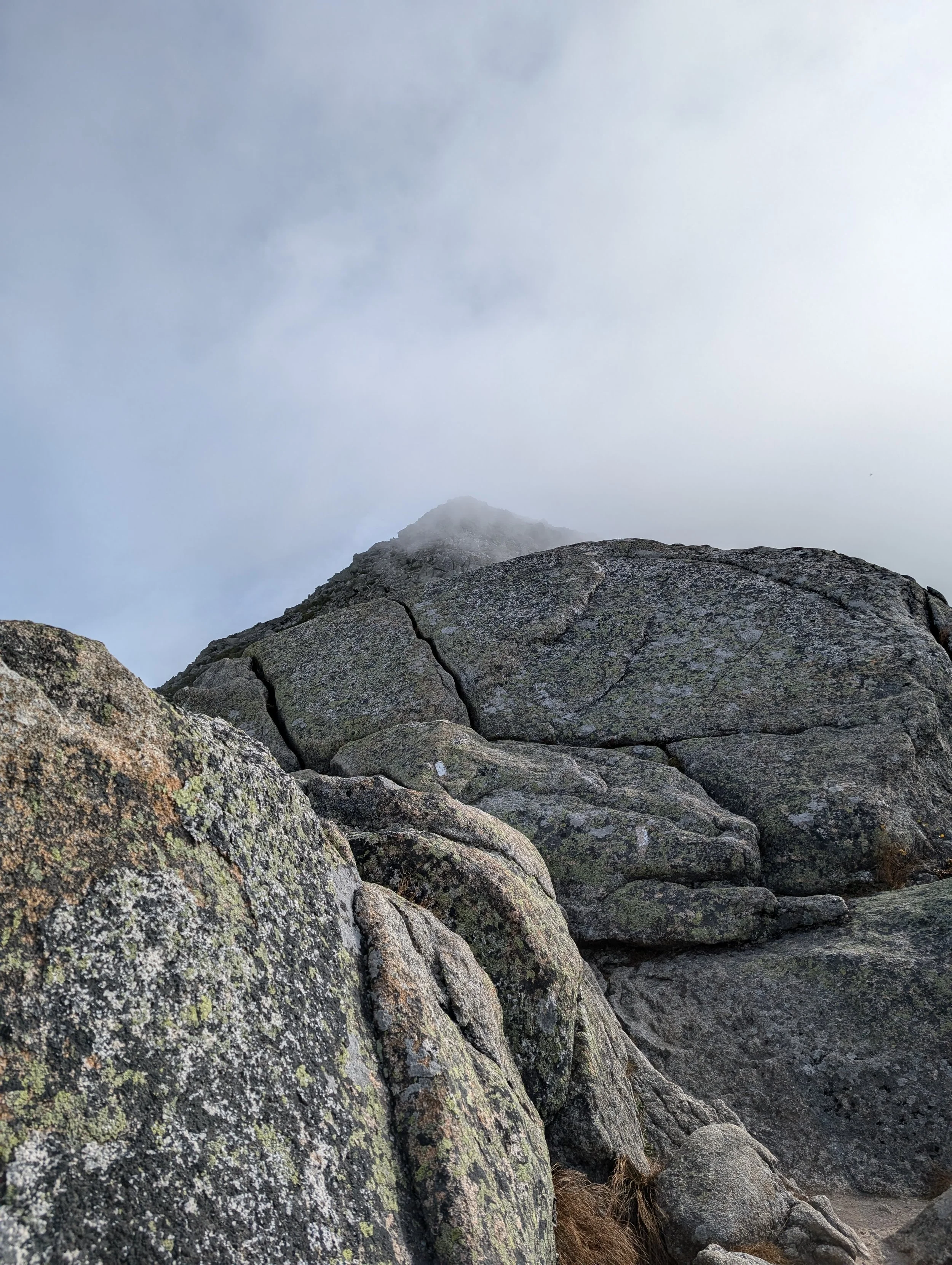
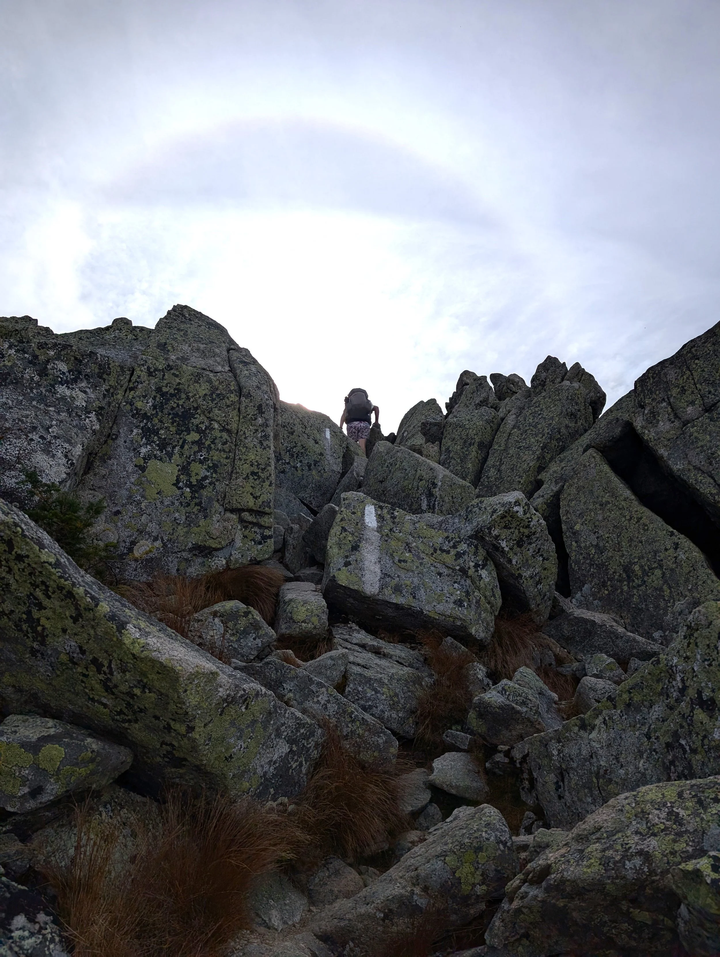
After the first 2.5 miles or so, we reached the boulders, which go on for about a mile. You really had to hoist yourself up and over these. In some places, there were some rebar handles you could use.
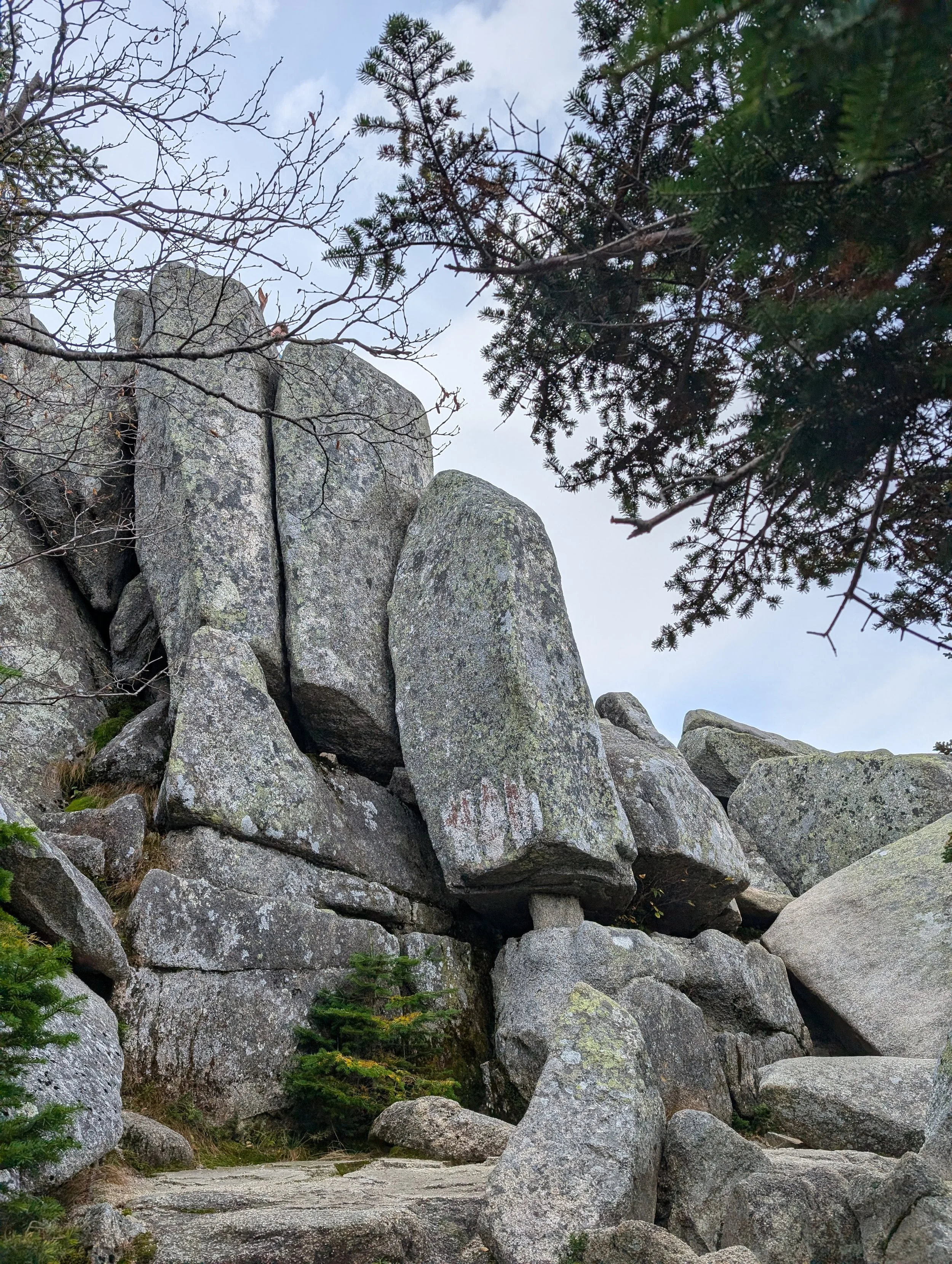
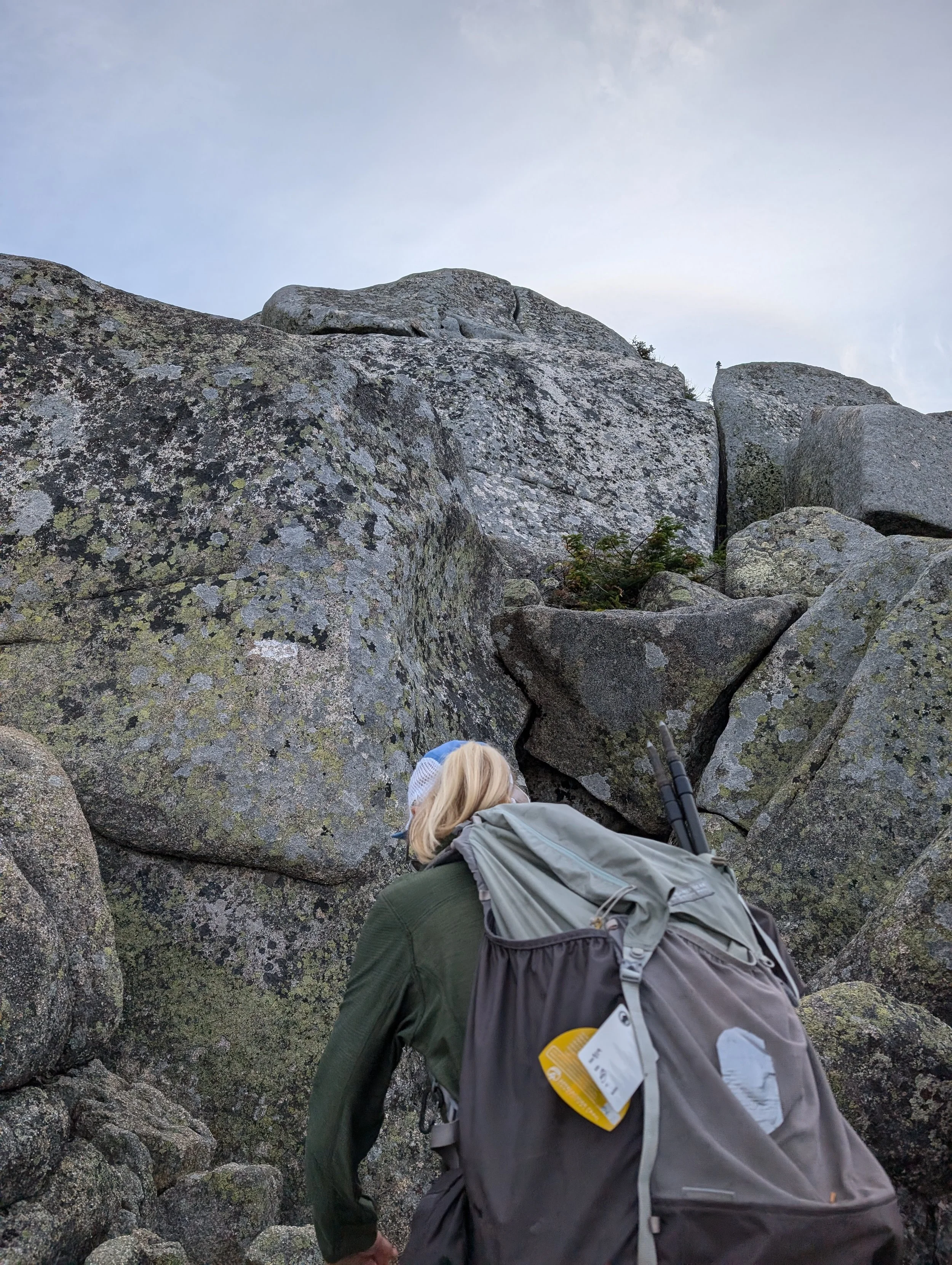

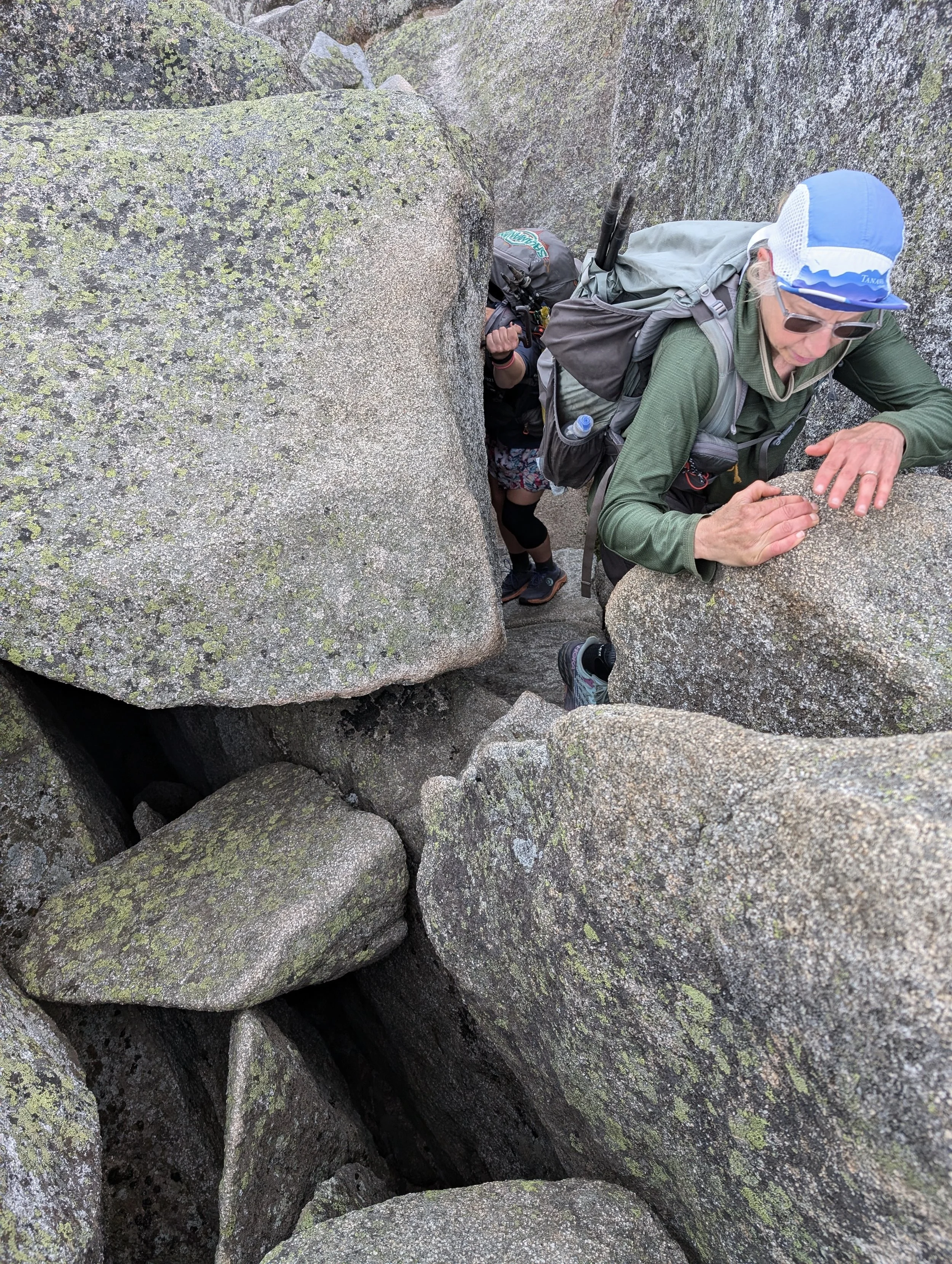

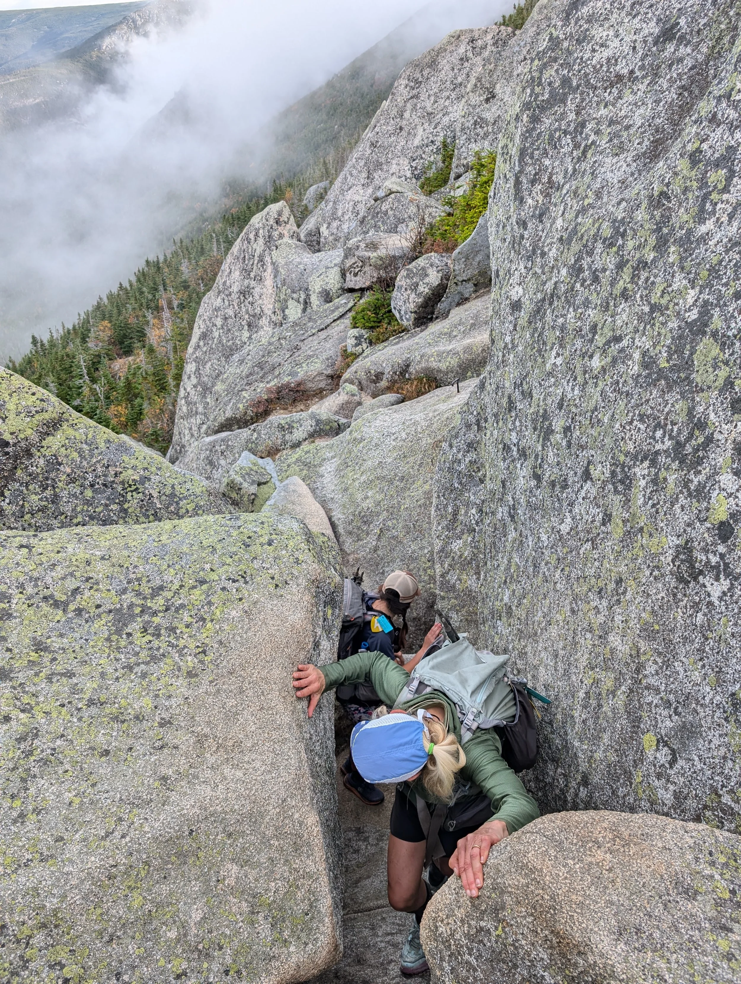
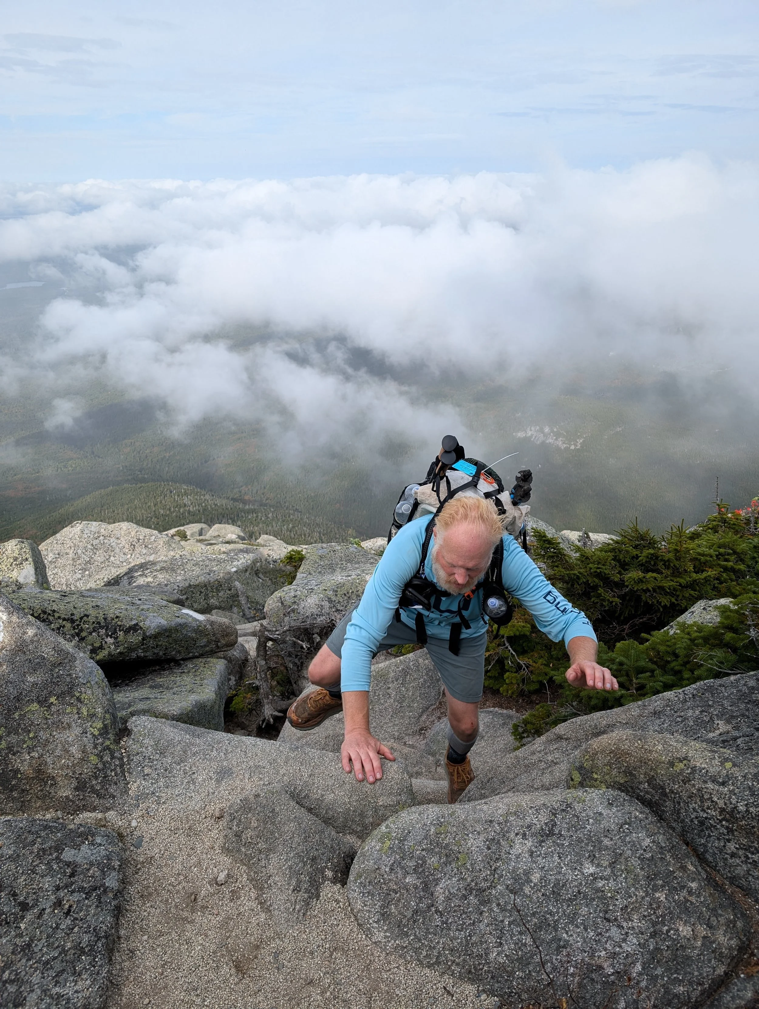
Then we got to what S. told us is called the Gateway. From far away, it looked like it was covered in smaller boulders than the ones we’d just climbed up, but when we actually got to it, we realized the rocks were pretty big, too. S. had spent the previous few weeks working on her fear of heights in preparation for the hike, and I saw her hesitate in a few places that were a little extra sketchy, but she kept going.
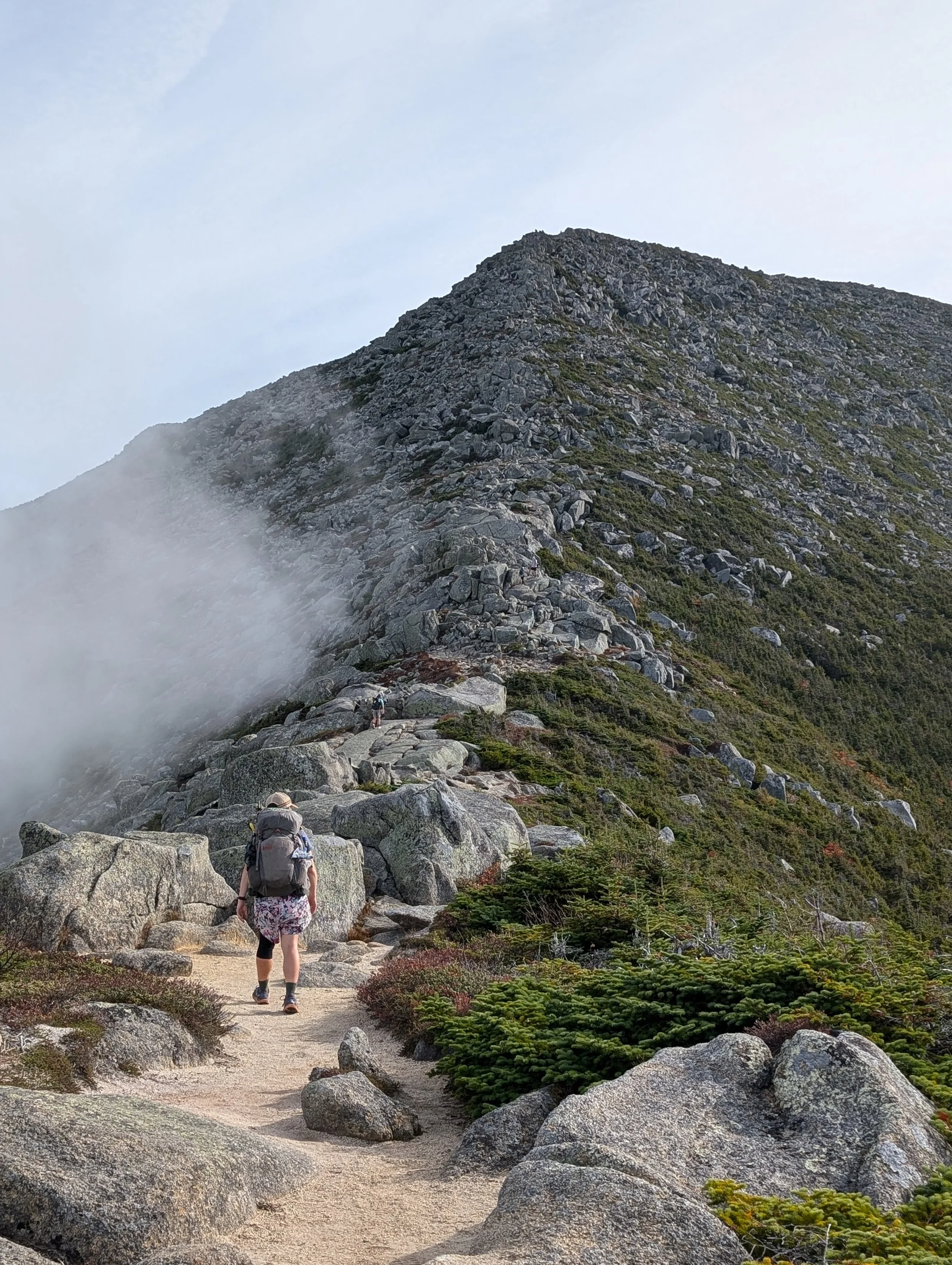

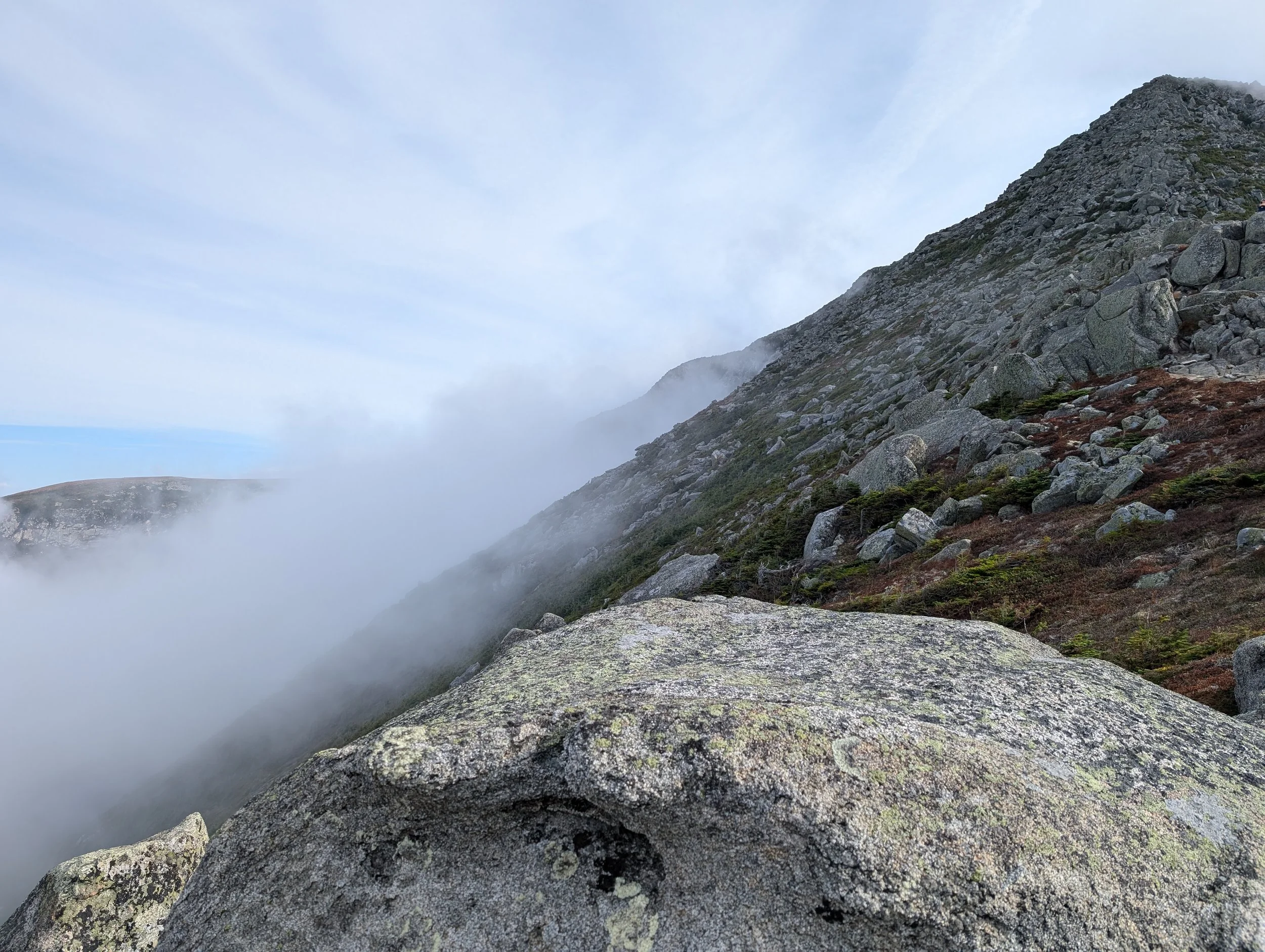


Just past the Gateway, we reached the area called the Tableland, where things flattened out quite a bit but were still rocky. We stopped there for a snack and a bit of a break before continuing on.


[Wife note: Now that we’d gotten past the worst of the boulders, I thought we’d just kind of be doing a leisurely stroll the remaining mile and a half or so to the summit, but as soon as we started walking again, the group basically took off. I had to practically run to keep up with everyone! I even had to stop and have Rob/Patch get me my Red Bull, though I don’t think it helped much in the end.]

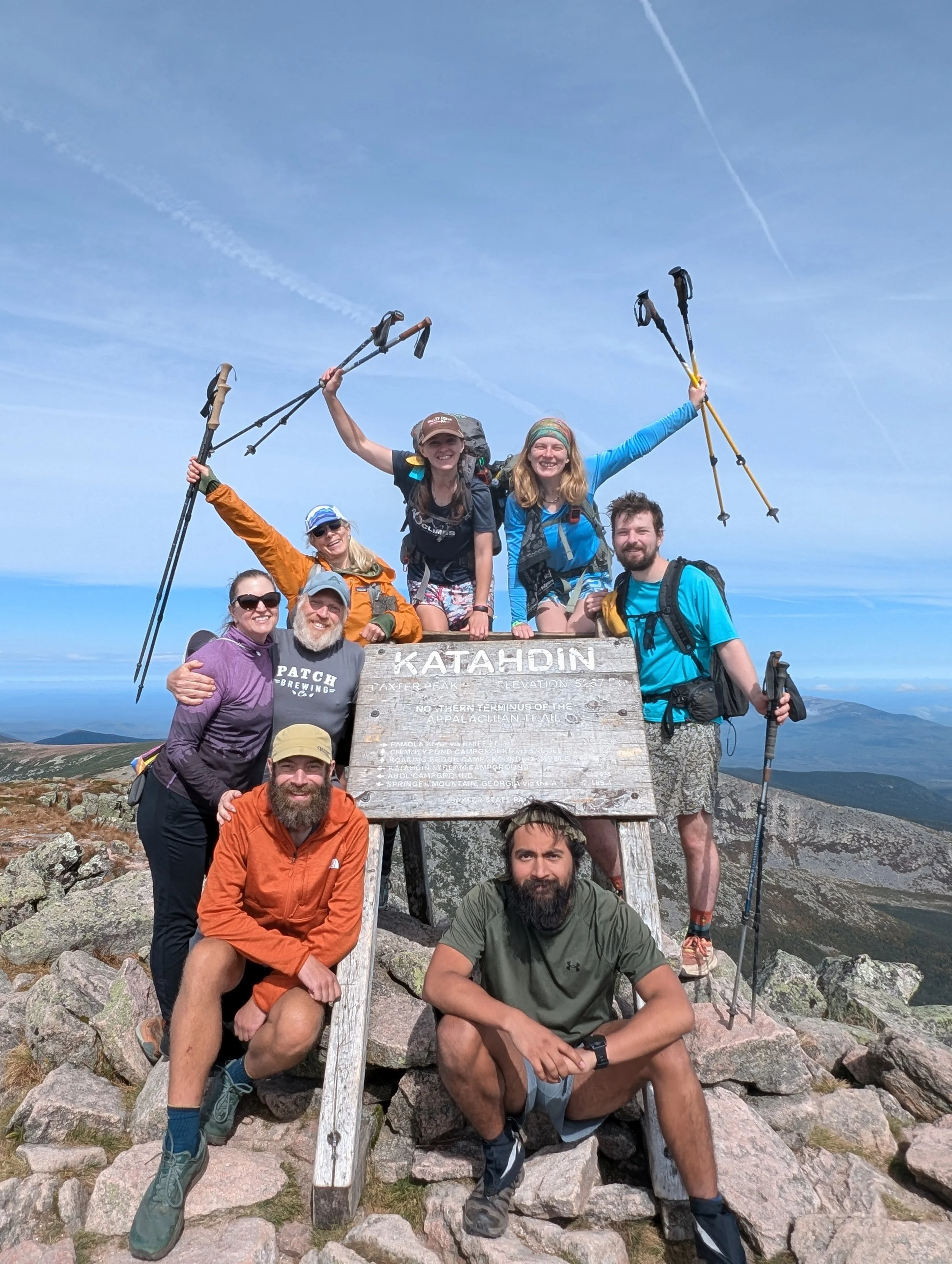
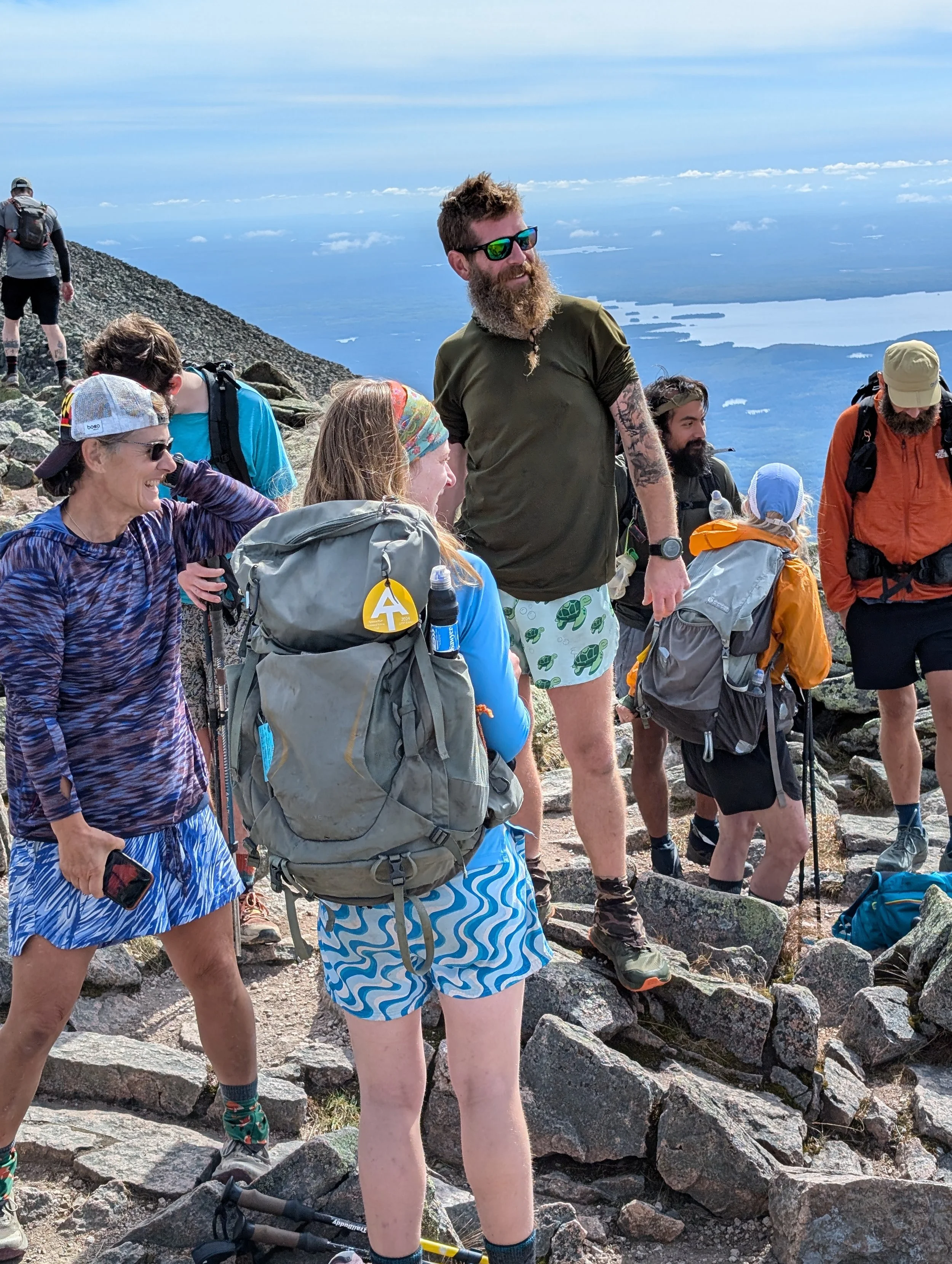
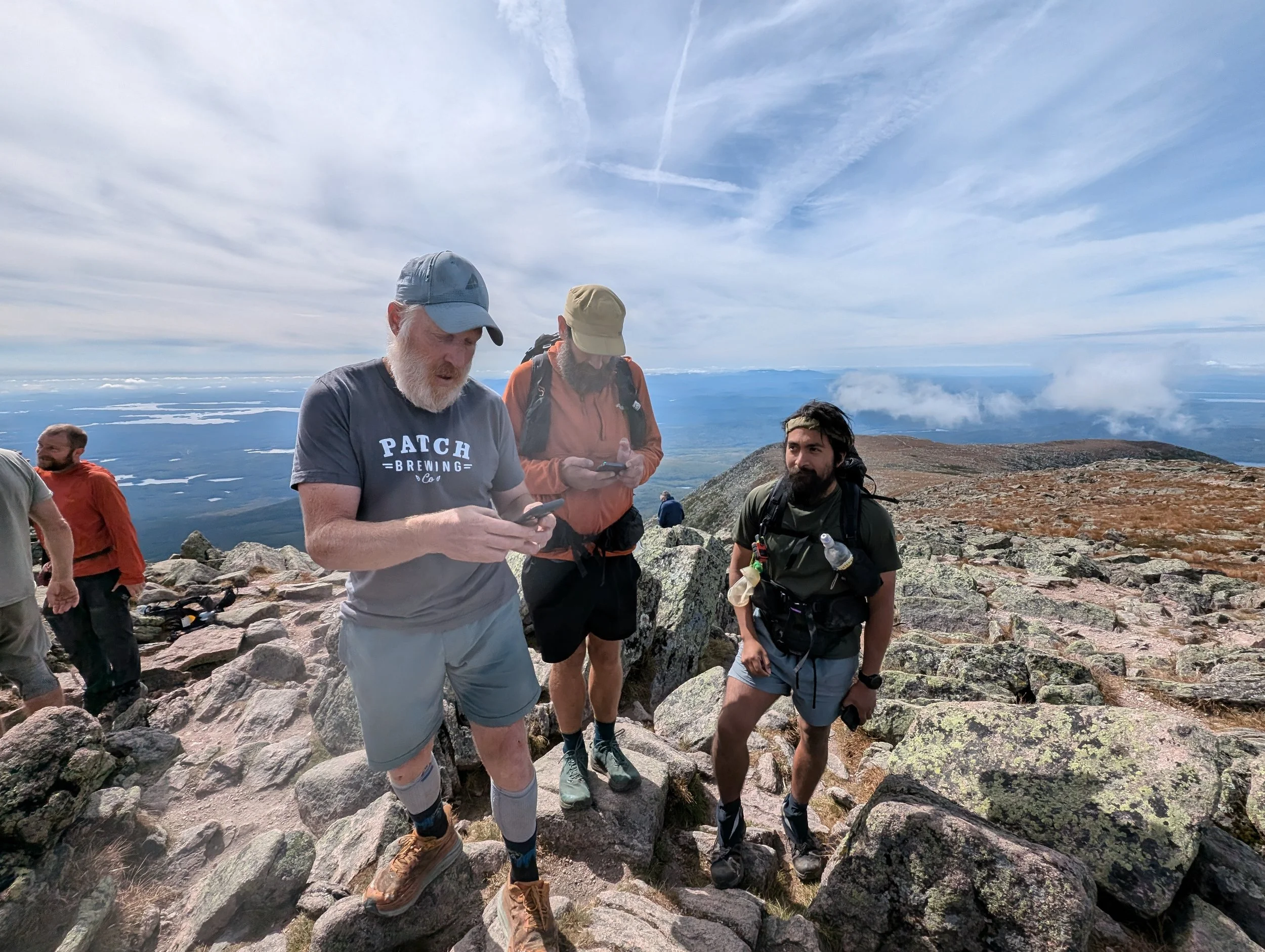
I think in all, it took us a little over four hours to reach the summit. Since Not Yet had gotten an early start on us, we’d all been joking on the way up that by the time we made it to the summit, he’d probably already be down the mountain and in Millnocket, drinking beers, so I was really happy to see him still at the peak when we got there. Munich Mule was up there, too, of course, as well as FIIK, Sundial, Boots with the Fur, Ranger, and a hiker we knew named Kittyslayer. [Wife note: Don’t worry — his trail name is ironic. No kitties were ever harmed or even in danger.] Since it was Friday and a nice day, there were a lot of day hikers who’d made the climb as well.


Salamander and Carolina Sunshine with Kittyslayer
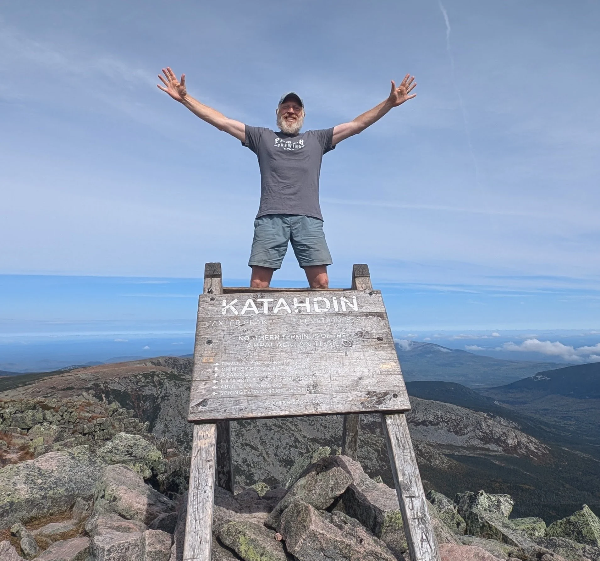
When I touched the sign, I just felt a big sense of relief. I hadn't known how I was going to react. I sort of didn't for some reason, but I did get a tad emotional when I saw some of my friends tearing up.
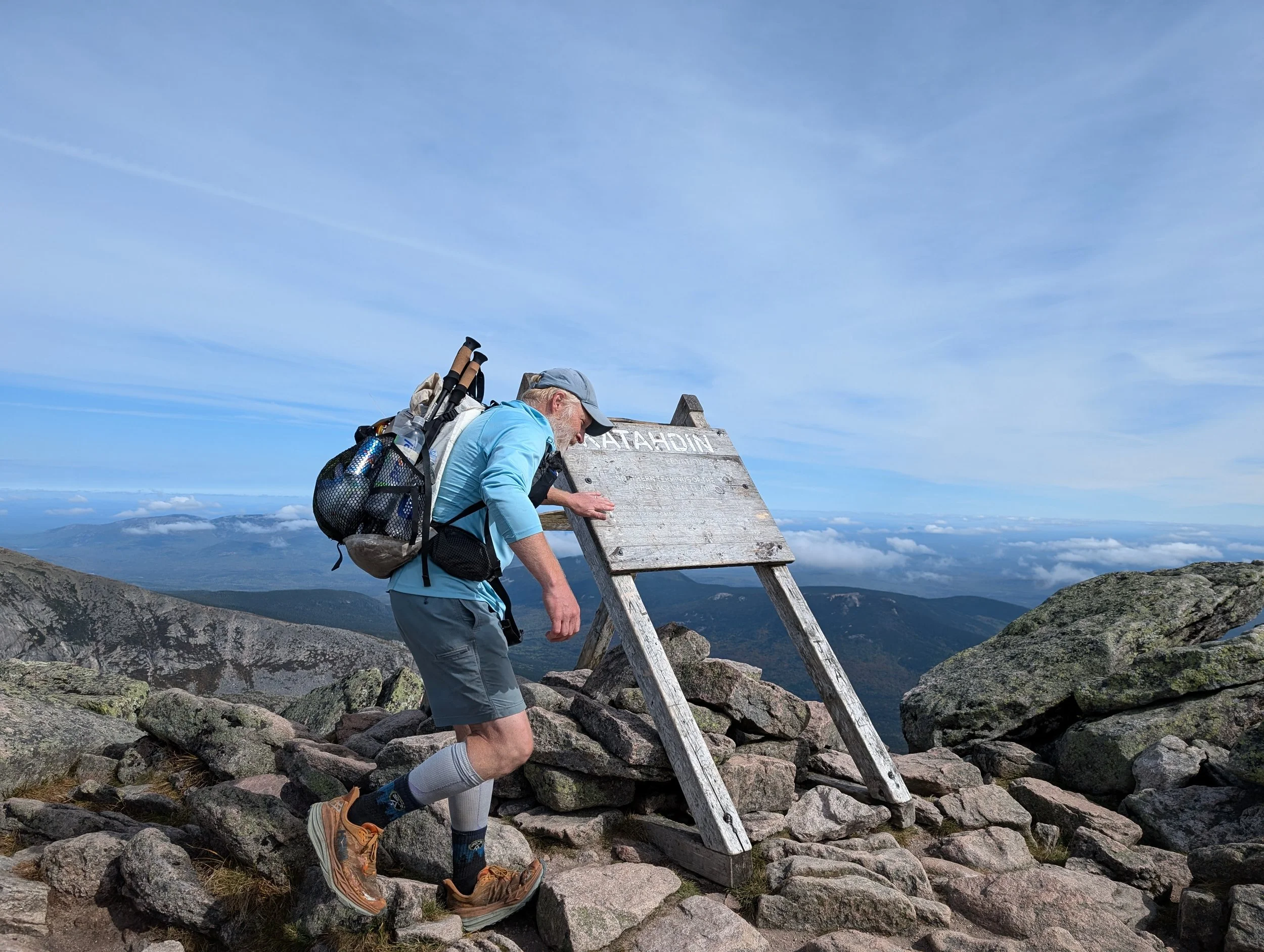
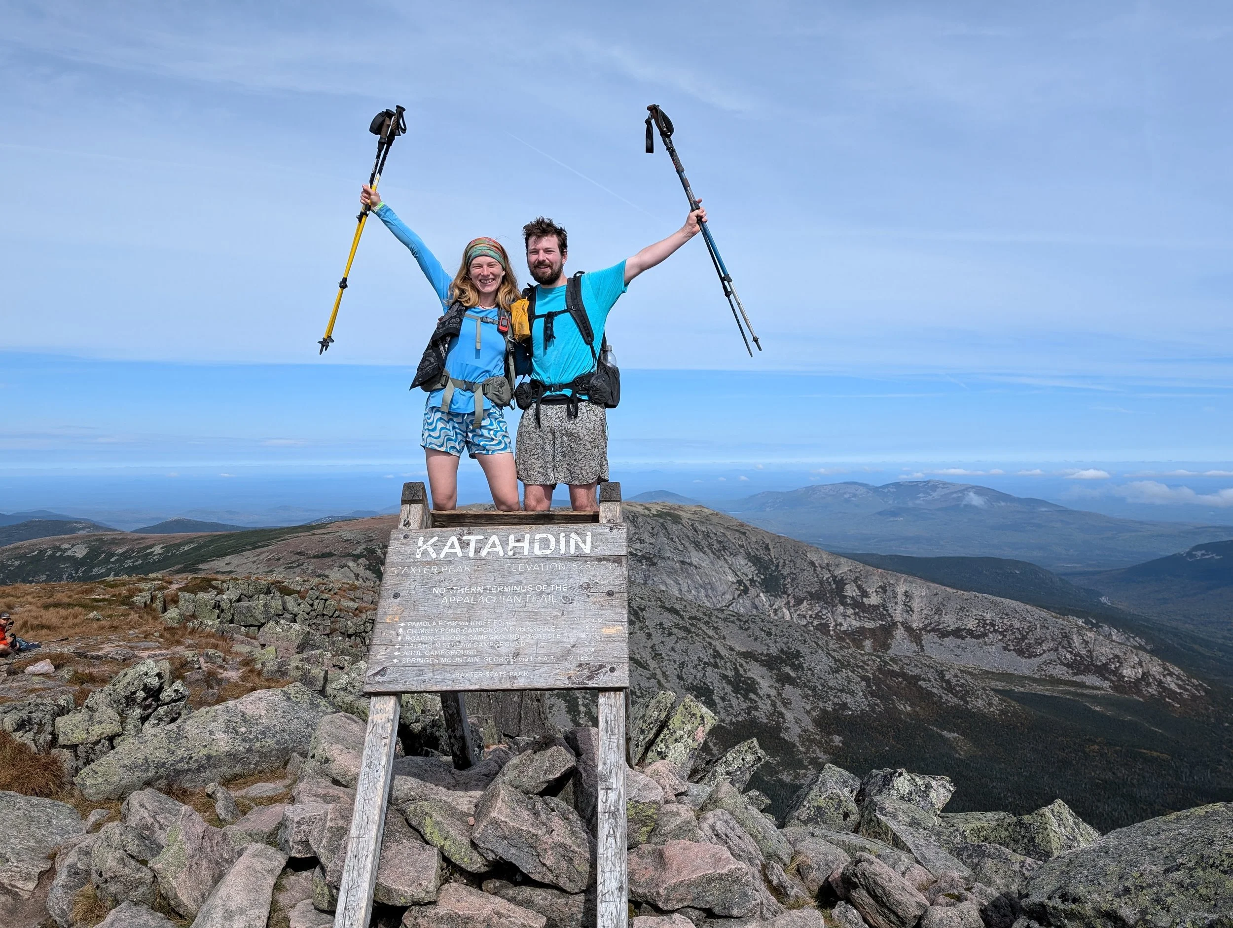
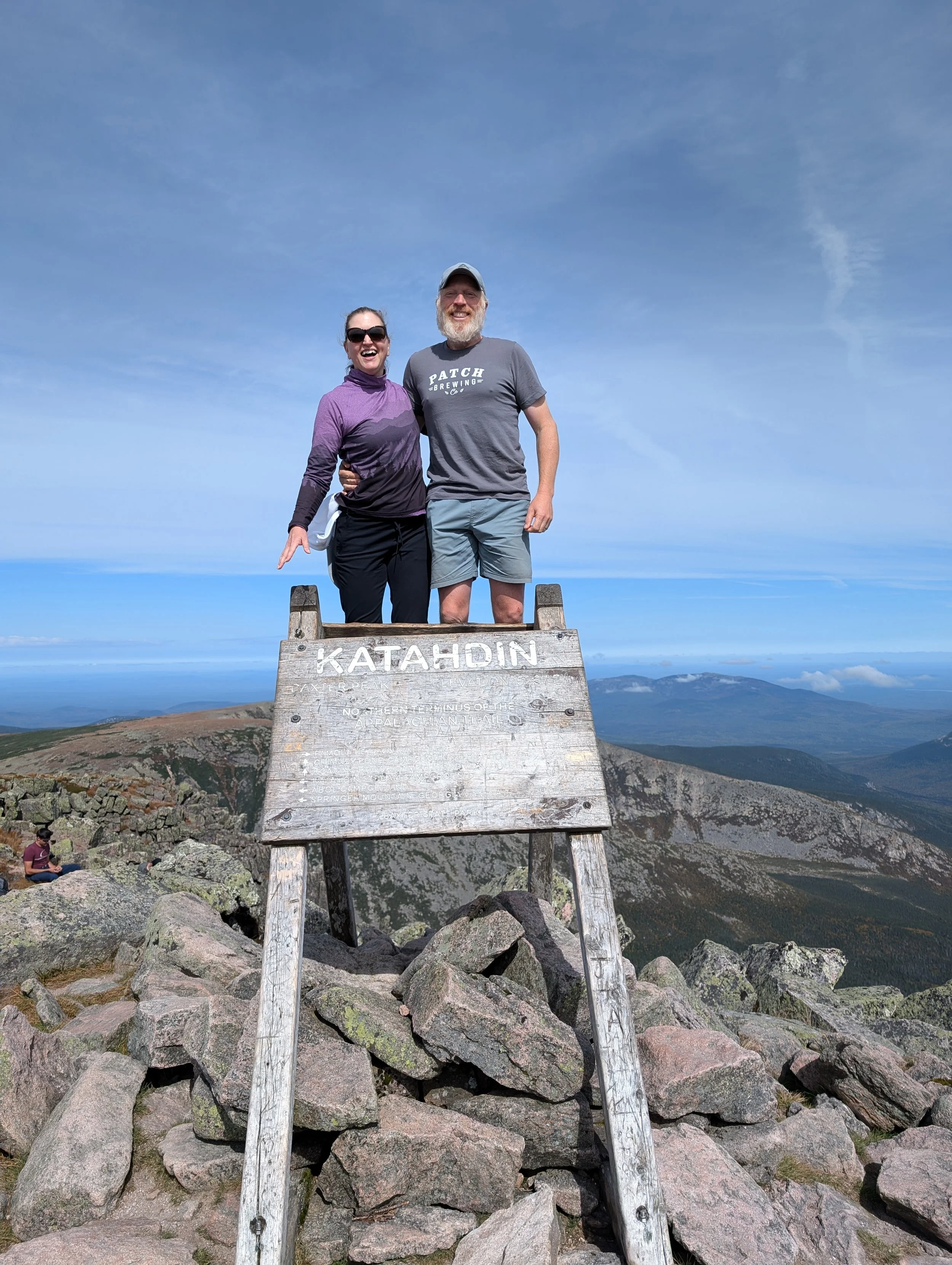
I had asked S. to bring my Patch Brewing shirt so I could wear it for my summit pic, so I stepped off to the side to change into that. Then we all took turns getting our photos taken on the sign and took a couple of group shots. I was thrilled to have S. there with me, since she was such an integral part of my hike. I couldn't have done it without her.


Carolina Sunshine
Groovy and Half Boot

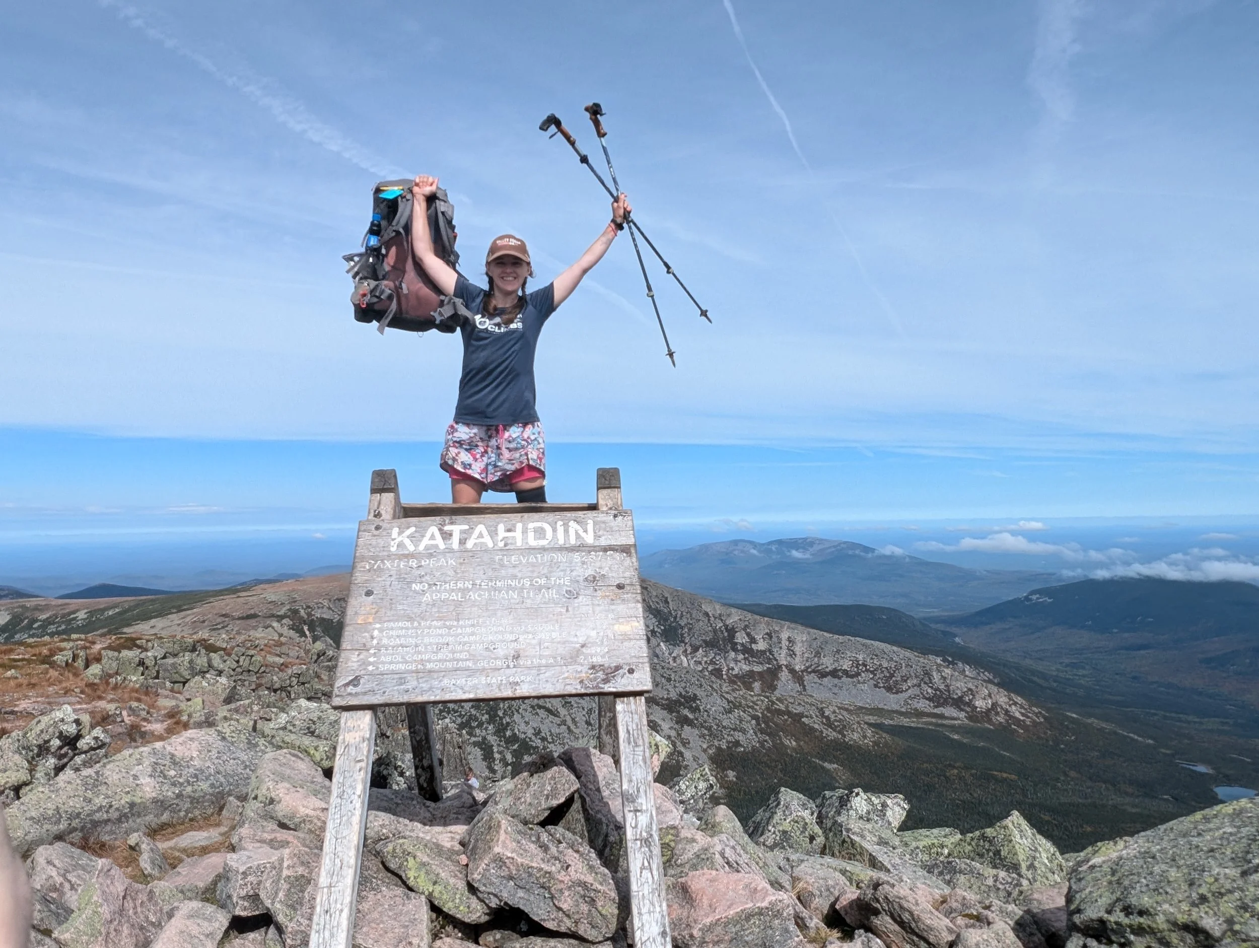
Salamander
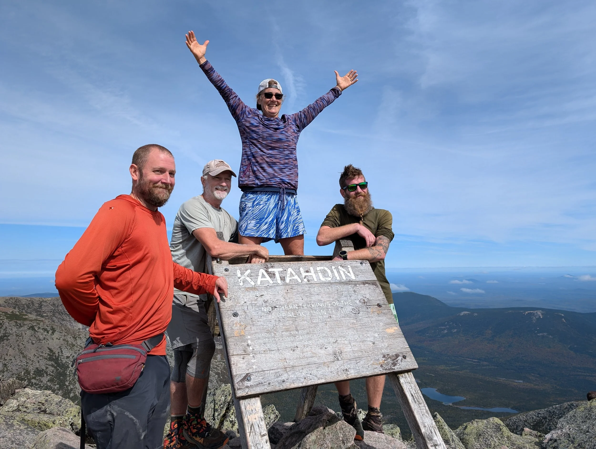
Left to Right: Boots with the Fur, FIIK, Sundial, Ranger

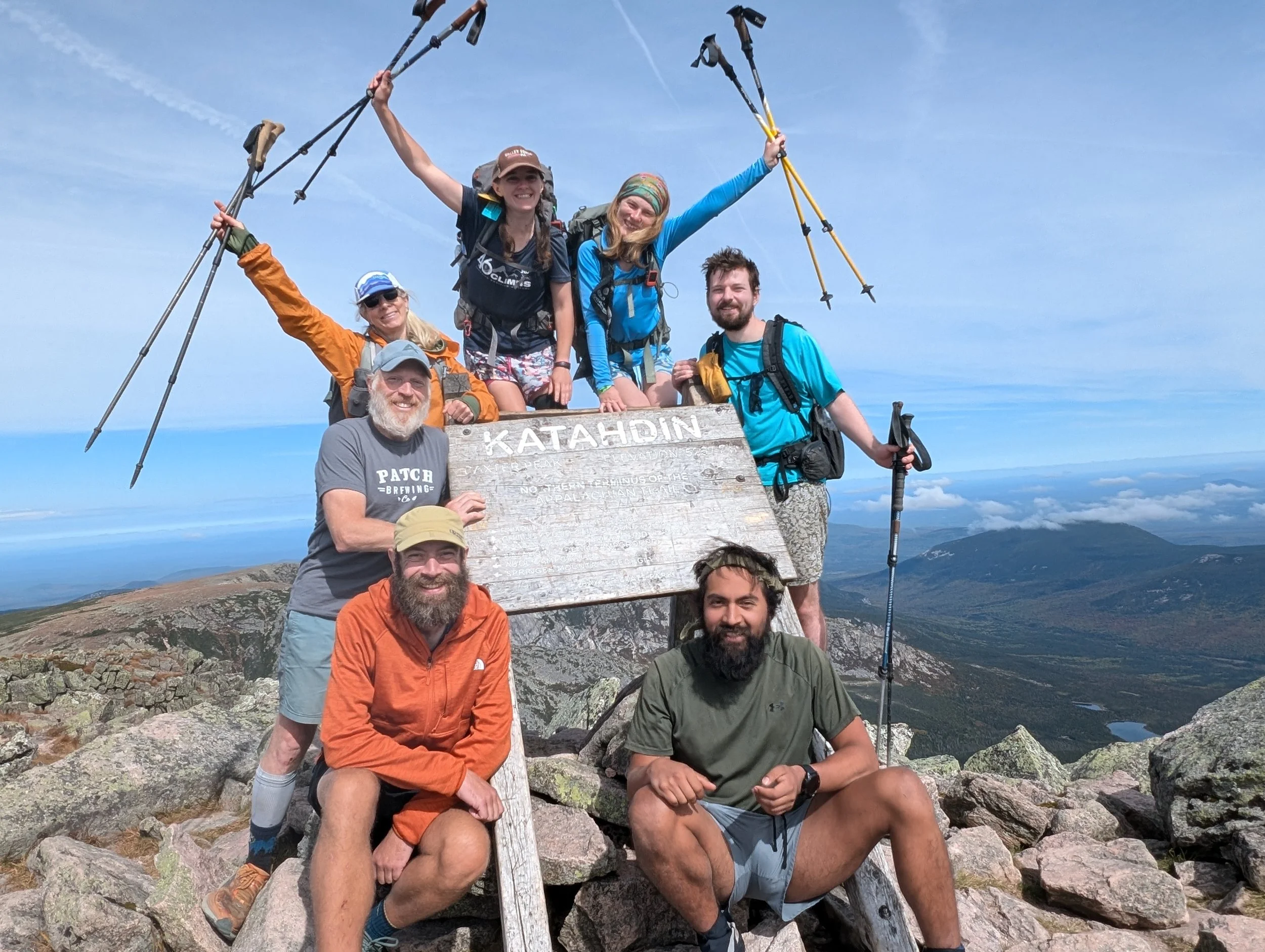
Clockwise from bottom left: Munich Mule, Patch, Carolina Sunshine, Salamander, Groovy, Half Boot, Not Yet
Hanging around other thru-hikers on the summit was kind of a strange experience. I mean, this was it. Now what do we do? We’d finally reached the end point, so there wasn't much to discuss anymore. And because the weather was so nice, we didn't really have any motivation to head back down right away. So everyone just sort of stood around, letting the moment sink in. I kind of joked that we were surrounded by some of the best views of the entire AT, yet no one was paying attention to anything but the Katahdin sign at that point.


Eventually, it seemed like a good time to begin hiking back down. We’d decided to take the Abol trail, which is shorter but significantly steeper. We didn't really have a strong grasp of just how steep until we saw that the trail just sort of dropped off the edge of a cliff. But I'll let S. tell you about that in a different post.

[Wife note: Check out this awesome video by Groovy, which includes the group’s summit day together. She features Patch as her hiker spotlight, too!]