Presidential Punishment
I started out today (August 24) at the Nauman campsite adjacent to the Mizpah Springs hut. I think I woke up at about 5:30. The tent site here is completely open to the sky, and I guess I never really realized how much the trees protect, or maybe block, your tent from condensation when you're in the woods. This morning, everyone's tent looked as though it had been raining all night.
At one point this morning, there was actually so much condensation that it started dripping on my head, which was less than thrilling. But nonetheless, I woke up, put away my wet tent, ate a little breakfast, and tried to get going as early as possible. I knew today was going to be a huge day — 15 miles up on the Presidential Range, most of the time above tree line.
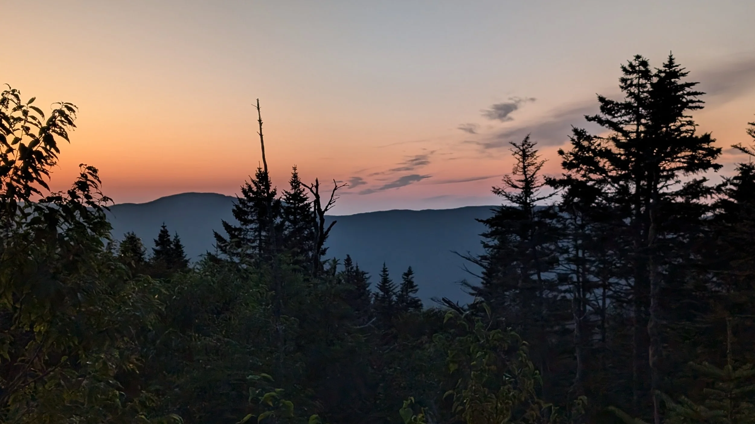
I got very, very lucky, because the weather could not have been clearer. I was all packed up and ready to go by about 6:40, and the first thing out of Mizpah was a pretty darn steep climb. But before too long, I got above the tree line and had just a spectacular view all day. I can't even imagine what it would be like to hike that stretch in terrible weather, so the whole time, I just kept thanking my lucky stars for the nice weather.


When you put a route into the Far Out app, there’s no way to kind of tell it that you want to stay on the Appalachian Trail the whole time. So when I put in the route I had planned for today, it came back saying there wouldn’t be much elevation gain or loss, which I immediately knew couldn’t be right. But I now know that that’s because Far Out chose to use every single shortcut possible around the Presidential Range. I'm not really sure why it does that. Maybe there's some kind of setting I could change that would restrict it to just the AT, but that's not really important right now.


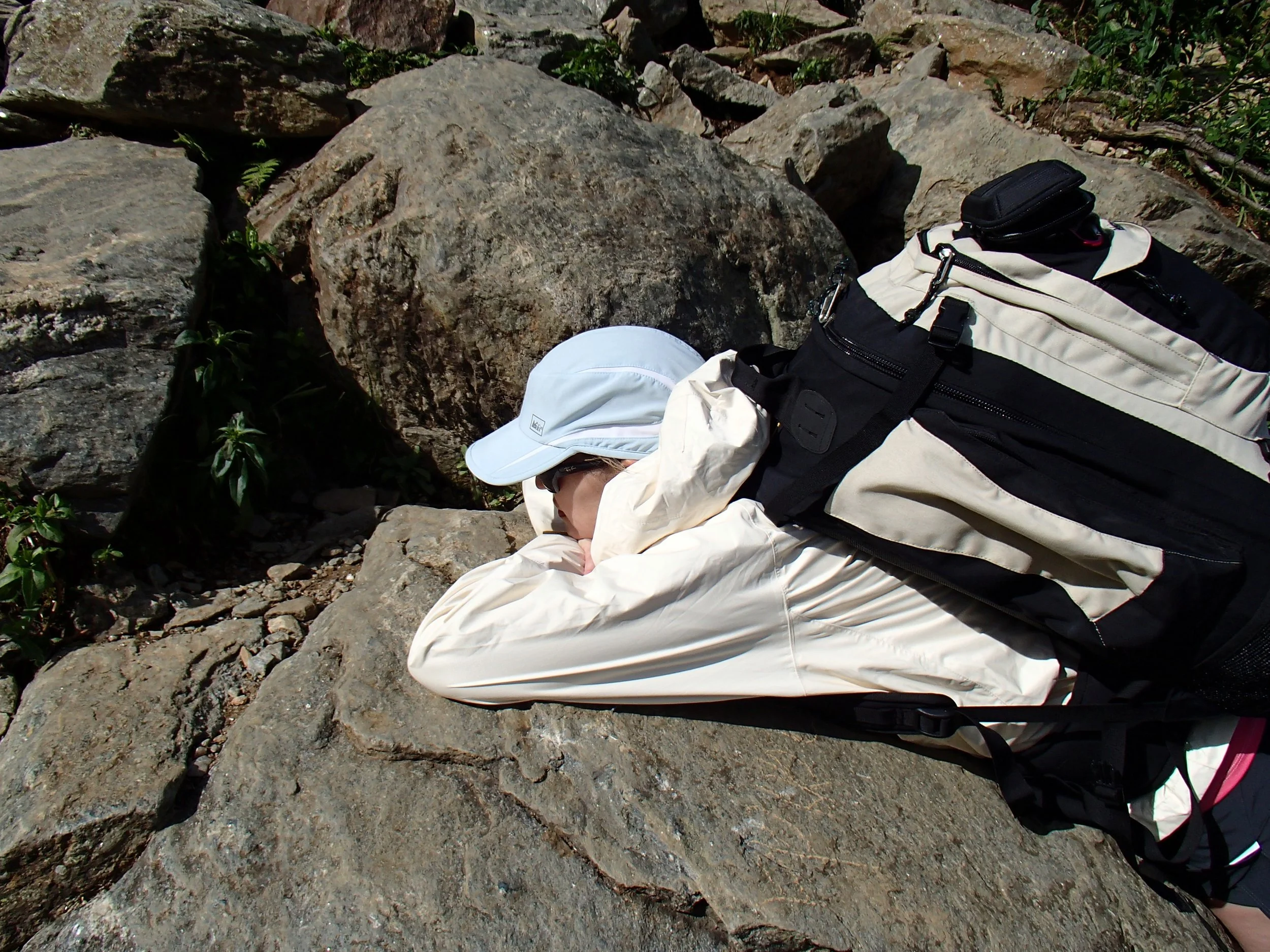
It turned out to be a very long day, as expected, full of big climbs and descents. My first stop was at Lakes of the Clouds hut, and to get there, I hiked past the top rim of Tuckerman's Ravine and was able to peer down into it a bit. Years ago, S. and I hiked up Tuckerman's, and she was none too pleased with the steepness of it. So I took a few pictures and texted them to her, and she texted back, saying, “My old nemesis!”
[Wife note: These are some pics from that long-ago hike. I have a terrible fear of heights, so whenever we’d stop, I couldn’t even stand up straight, because I was afraid of tumbling backward down the mountain. This was me getting as flat as I could while small children happily ran up and down the hillside past me.]
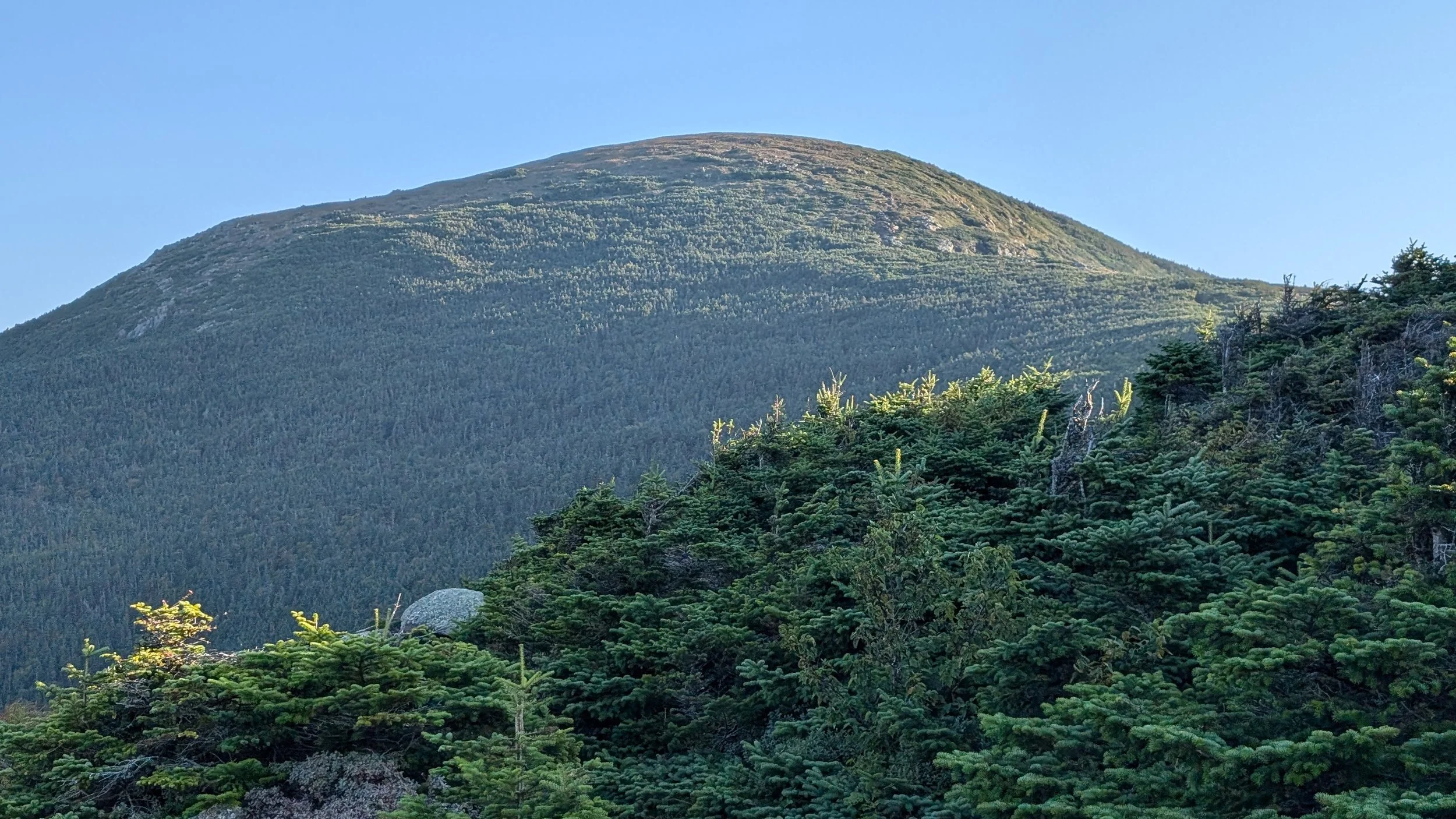
Lakes of the Clouds hut was about 4.5 miles into the day, and it is by far the most popular hut in the White Mountains because of its proximity to Mount Washington, its elevation, and its spectacular views. All the thru-hikers were going into the hut, and it was just bustling with activity with other people who were not thru-hikers. I warmed up with a cup of coffee — or more accurately, I had a cup of sugar that was diluted with just enough coffee to make it drinkable. And to kind of max things out, calorie-wise, I had a 500-calorie Danish with it.


From the hut, it’s a 7-mile hike to the summit of Mount Washington and something like 1,500 feet in elevation. So it’s pretty steep. I got to the summit by around 10:30, I believe, which was great, because I wanted to have plenty of time for the miles I needed to cover this afternoon.


The peak of Mount Washington is an interesting place, especially on a clear day, because there’s a cog railway you can take up to the summit, and you can drive up to the summit.


So there are lots and lots of tourists up there, in addition to hikers, and everyone wants to touch the Mount Washington summit sign and have their picture taken with it. At one point, there had to have been 50-plus people in line. So I didn't technically get to the peak of Mount Washington today, because I really didn't feel like waiting in line behind 50 people. I've been up there before multiple times, and I got close enough this time — maybe 15 feet. So I’m not feeling any remorse about not hitting the absolute peak.

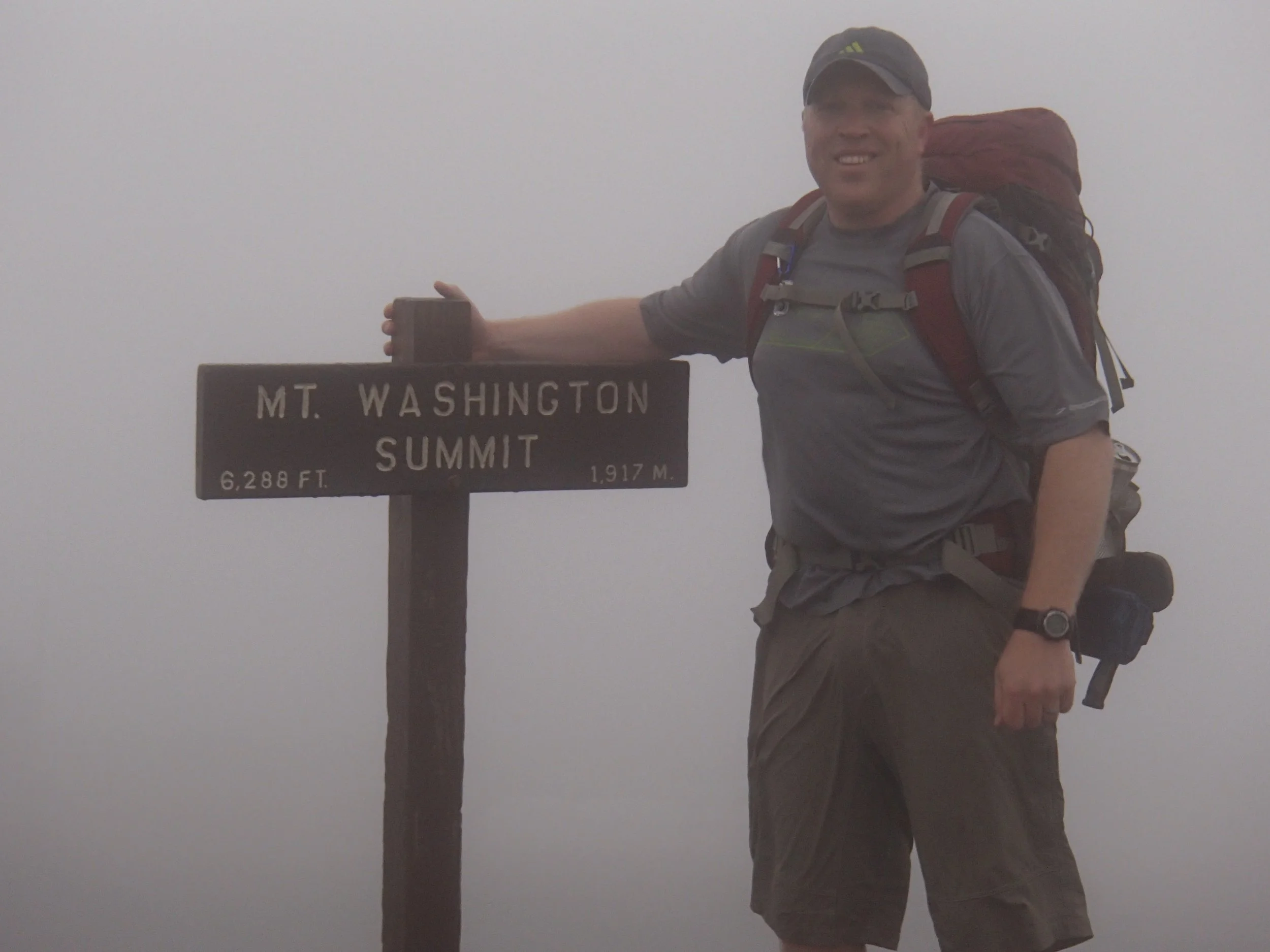
Proof! 🙂
One particularly nice feature of Mount Washington is the summit building there, which has bathrooms and a bottle filling station and, most importantly, a cafeteria kind of area where you can get something to eat. So I got myself a sandwich and a Whoopie Pie and a Coke and sat inside while I ate. I was trying to get in as many calories as I could before I headed out again. I texted S. to let her know I was having some lunch on Mount Washington, and she reminded me that there’s now a live webcam on the observation platform on top of the café and basically told me to go find it. So, once I’d finished eating, I located the X and waved at the camera.
After that, I talked to a few tourists about being a thru-hiker, and then it was time to get going. It was actually getting quite chilly up there. The second half of the day was absolutely, by far, much more difficult than the first half had been, and the first half hadn’t exactly been easy. And one thing I’m realizing as I get further into this hike is that going up is actually preferable to going down, especially when the trail is steep. I mean, gradual descents are lovely, but those are few and far between these days.


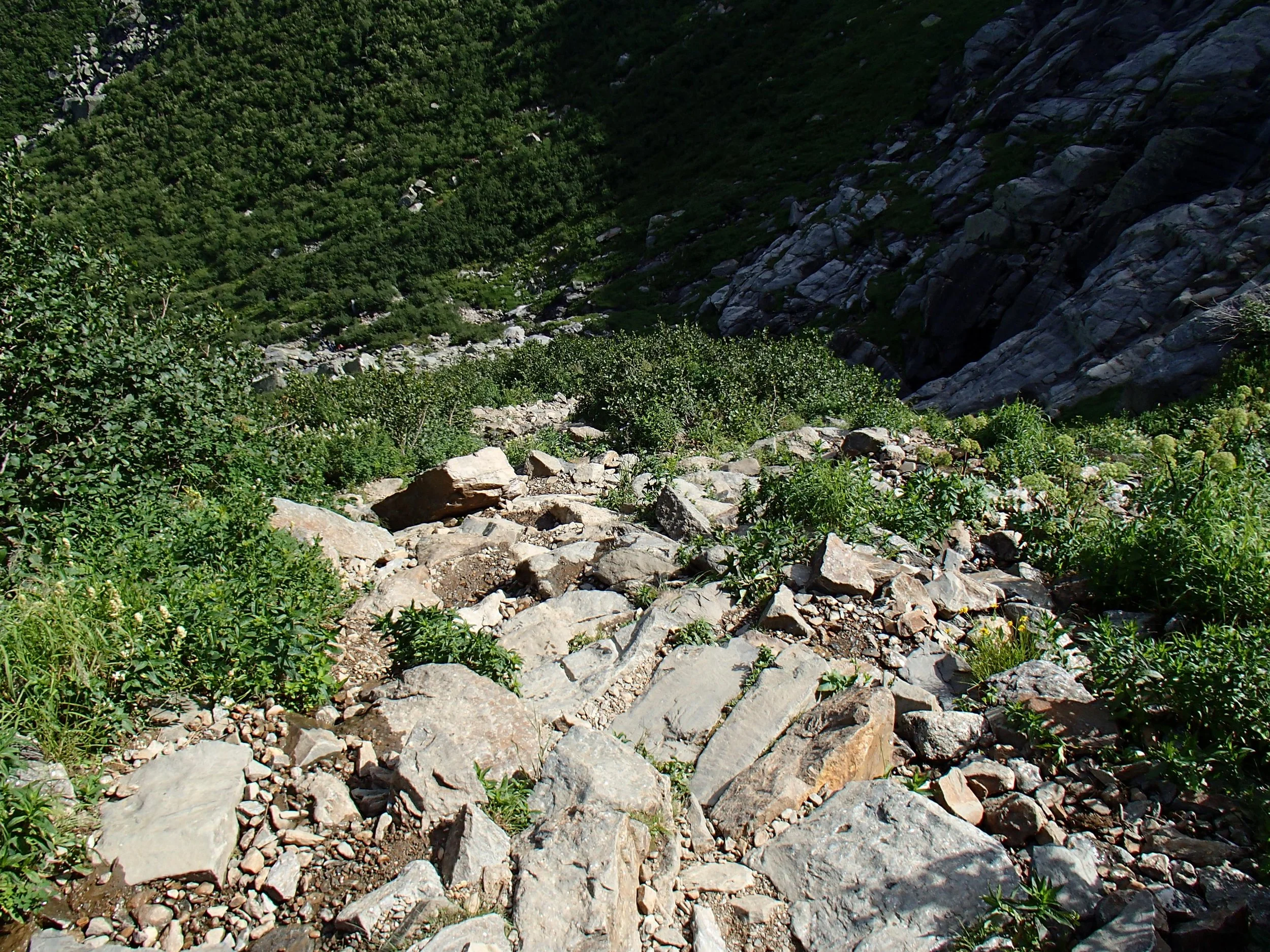
The first part of the descent from Mount Washington was incredibly steep and rocky. And there was also a fundraiser going on for a group called I Hike for Mental Health, so there were just hordes and hordes of people coming up to the peak from the opposite side from where the AT is. And no criticism here, but it did make things very slowgoing. I'd get down over a few rocks and have to pull over to let a bunch of people go up. I’d go down over a few more rocks and have to pull over again to let more people go up. And so on, and so on. It was definitely hindering my progress.
The next destination after the peak of Mount Washington was Madison Springs hut, which is about 5 miles south of the peak, even though the AT was headed northbound. The most efficient way to get north from Mount Washington would actually be to go down Tuckerman's Ravine to Pinkham Notch — which is the base camp, so to speak, for Mount Washington — but I guess the AT people wanted to route the trail over some more of the Presidential peaks. So the northbound Appalachian Trail actually heads south to Madison Springs hut.


And those 5 miles in between are very, very challenging. It's a lot of descent, a lot of rock scrambling, and a lot of people. It ended up taking me quite a long time. And as I was making my way to Madison, someone just breezed by me and then looked back and said, “Do I know you?”
And it was Pyro, whom I hadn't seen since Massachusetts. It was nice to see him again. And then when I made it to Madison Springs Hut, I saw Quadzilla. He and Pyro had been hiking together when I saw them in Cheshire. They hiked ahead, of course, because they’re super hikers. And what they did was, they got to the Maine Junction, which I explained in an earlier post is where the AT and the Long Trail diverge after being one and the same for about 100 miles. From there, the Long Trail continues north to the border of Quebec, while the Appalachian Trail heads east toward New Hampshire.
And when Quadzilla and Pyro reached the Maine Junction, they hiked out to the road and caught a ride up to the northern terminus of the Long Trail. Then, they hiked the Long Trail all the way back down to the Maine Junction, where they switched back over to the AT and then proceeded north. [Wife note: Did everyone get that? I tried to represent it on a map I found. The red line 1 shows the AT up to the Maine Junction. The orange line 2 shows their hike on the Long Trail down from Quebec. And the purple line 3 shows where they got back on the AT and headed north.]

So I’d seen them about 200 Appalachian Trail miles earlier, maybe a little bit more, and they caught up with me after doing an additional 170 miles on the Long Trail. That means that in the time it took me to do, let's say, 220 miles, they did 390. They’re just incredible hikers.

With Quadzilla

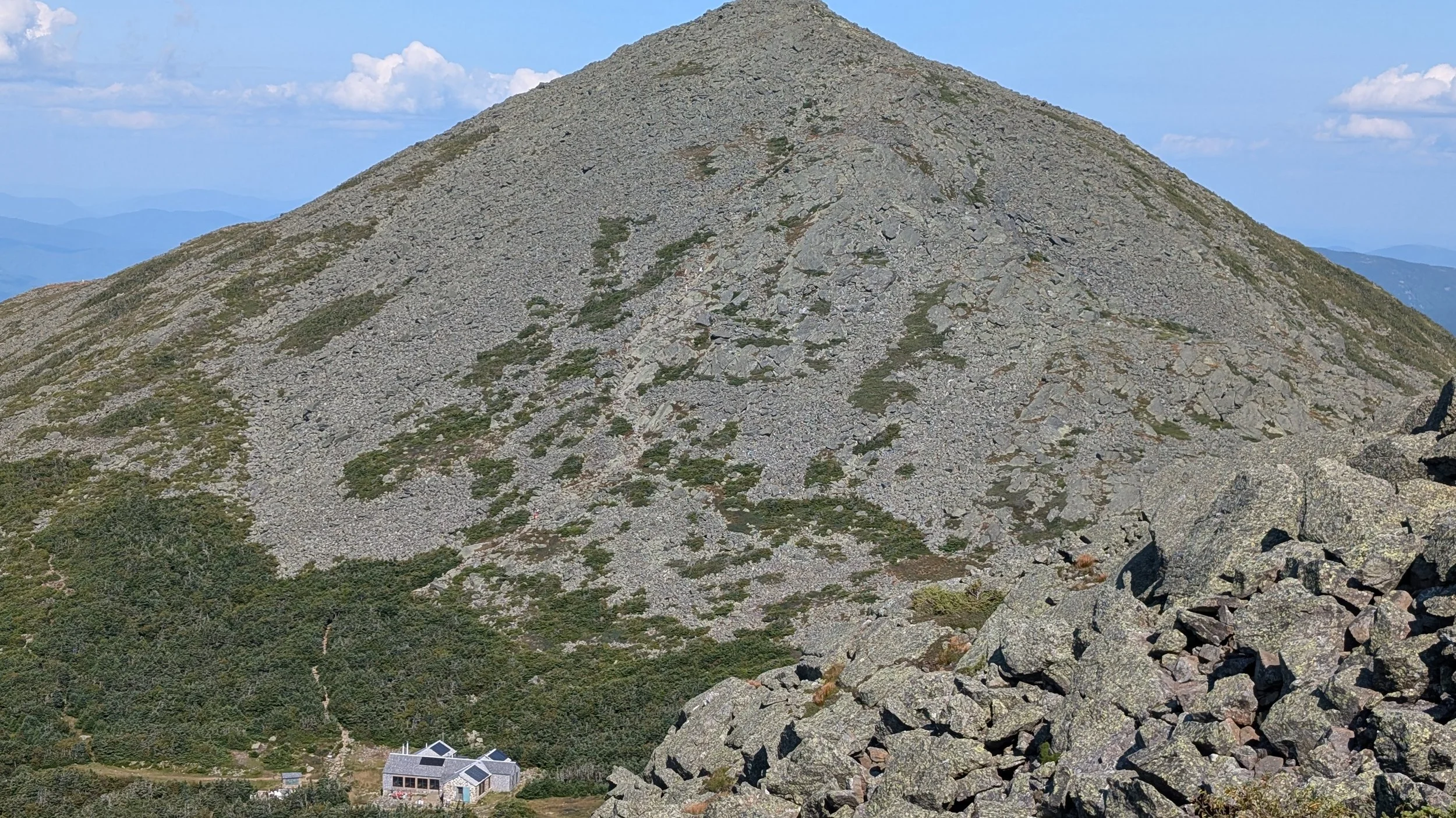
From the Madison Springs hut, it’s “only” 3 miles — and I'm putting “only” in quotes —down to the Osgood tent site, but to get there, you first have to go up Mount Madison, and it’s a very steep ascent. It's basically straight up for a half mile to the peak of Mount Madison. And then you've got a descent that’s something like 3,500 feet over 2.5 miles, which is just ridiculous. A lot of people on Far Out were commenting that it took them four hours to go those 3 miles. So I was a bit nervous about it, and I was already tired from the day, but I needed to keep pushing forward. And it was just a punishing hike on the knees and legs and everything else.


At around 7 o’clock, I made it to the Osgood site, so it was a good 12-hour day. I set my tent up in the first available spot and just ate some salami for dinner. I’m too tired to actually make anything to eat. Today was definitely the toughest hiking day I’ve had on the AT so far. Looking at Far Out, I think I did close to 6,000 feet of climbing and more than 6,000 feet of descent. That’s just a huge day. I’m glad I got so lucky with the nice weather.