Loons on the Lake

All right. Today (September 16) was day four in the 100 Mile Wilderness. I woke up at the East Branch lean-to, which is adjacent to the east branch of the Pleasant River, for those of you who might be interested in that. I needed to get going pretty early this morning, because I had to meet my food drop from Shaw's Hiker Hostel at a road crossing about 12 miles north of my campsite, and I wasn't really sure how long that would take me. So I definitely wanted to give myself as much time as possible.
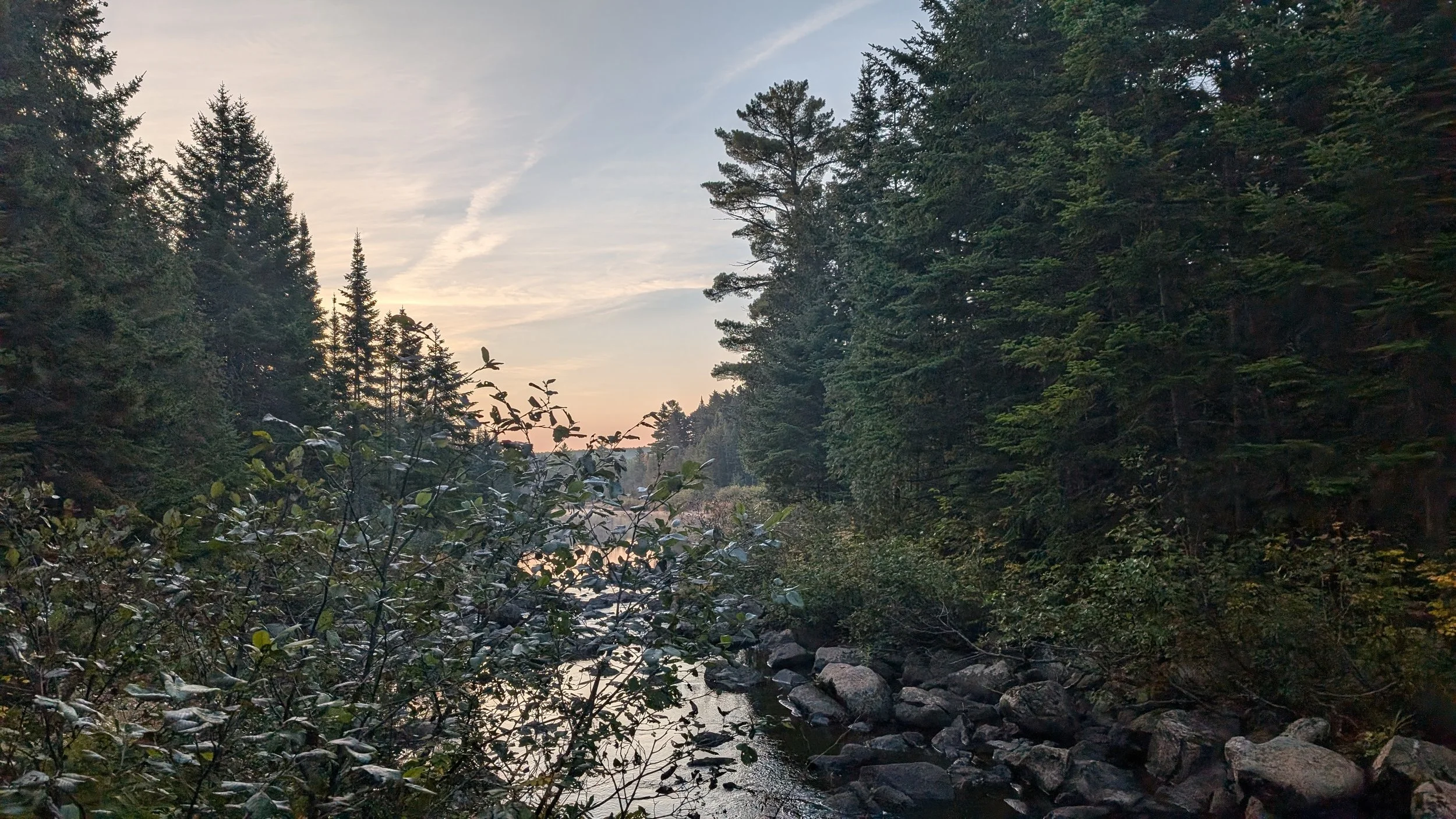
I left at about 6:40, would be my guess, and immediately came to the river crossing of the east branch of the Pleasant River. Huge surprise. And as I’ve mentioned a few times already, in years gone by, some of these fordings have been pretty dangerous. Because of extended rain, the rivers have been deep and flowing pretty quickly. But fortunately for us, we just had a pretty easy rock hop across.
I remember seeing hikers in videos from last year and the year before, really struggling to get across in some places. When I’m home again, I want to revisit some of those videos to see if I can kind of match up where I had an easy time and people in previous years had a very difficult time.
The beginning of the day had two reasonable climbs. Nothing too terrible, though. After the second climb, there was a descent, and then the trail really flattened out. It should be that way for the final 50 miles or so of the 100 Mile Wilderness, which is a very welcome change, because Maine up to this point has been quite mountainous and very slow hiking.


It turned out that I didn't really have to worry about hiking the miles quickly enough this morning. I ended up making great time and arrived at the resupply drop-off point by 12:30. I didn’t need to be there until 2:00, but it was nice to get there early. While I waited, I hung out with Boots with the Fur and his hiking partner, Ranger. We were chatting by the roadside when the guy from Shaw's showed up at around 1 o’clock. I’m not sure why he came so early, but I was thankful for it.
I got my resupply and packed everything into my backpack. I also got a Coke, which was great. I chatted some more with everyone who was there, picking up, and the big topic of conversation was which trail to take going up and then down Katahdin. The AT goes up what’s called the Hunt Trail, so the consensus is naturally to finish by summiting via that trail.
As for coming back down, the consensus seems to be to take the Abol Trail. S. and I will have to discuss that and figure out which way we want to go down. Apparently, the climb up via the Hunt Trail isn’t something people are too keen about having to navigate going down. And the Abol Trail is shorter — it’s around 4 miles total, versus 5.2 — but that means it’s a lot steeper, since you’re obviously covering the same elevation, more or less. You also have to then walk the 2 miles back to the campground afterward. It feels kind of crazy to me that we've gotten to the point that we’re talking about picking the trails we want to take up and down Katahdin.
[Wife note: The Friends of Baxter State Park website categorizes the Hunt Trail as “extreme” and describes it as follows: “This 5.2 mile tail is the terminus of the Appalachian Trail and is a difficult climb. It starts at Katahdin Stream Campground and follows Katahdin Stream for the first mile. The trail starts out with forested terrain before reaching ‘The Gateway’ and transitioning to a rocky, open ridgeline with incredible views.... Note: Very strenuous hike.”]
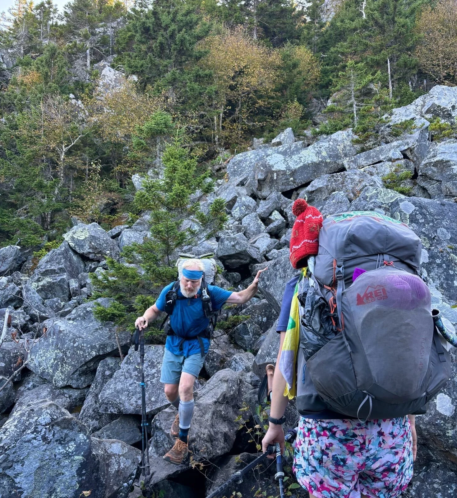
Hootie and Not Yet showed up to pick up their resupply drops, and I hung out with them for a bit and had a snack. By the time I was finishing up, Salamander and Carolina Sunshine arrived, and we headed to the next campsite together, which was just another 4 miles down the trail.


Again, we were lucky to have another absolutely gorgeous day. And at one point, we crossed paths with a few people from the Maine Appalachian Trail Club who were out doing some trail cleanup. We all thanked them profusely for maintaining the trail so beautifully. One of the guys lives next to an apple orchard, and whenever he’s going out to work the trail, he heads over to the orchard first and picks a whole bag of apples and brings them with him. So I got to enjoy a really nice, fresh apple, which is always a wonderful thing.
We made it to the Antlers campsite by about 4 o'clock, after covering 16 miles. This campsite is very special, because it sits on a peninsula that juts out into a lake. And the 100 Mile Wilderness is completely unpopulated, which makes it so beautiful and peaceful out here. It definitely reminds me of Pine Island Camp, which I just love. Everyone set up their tents near the water, and we sat around and had dinner together while we listened to the loons out on the lake. And because we’d gotten to the campsite on the early side, I had some time to hang some things out to dry, which was great.


We’ve got a big hiking day tomorrow. We’re hoping to do close to 22 miles. Now, the trail is pretty flat for the whole 22 miles, so it seems totally feasible. My goal is to get to the edge of Baxter State Park on the 18th, which means I've got those 22 miles to cover tomorrow, followed by about 15 miles the next day. That’ll put me into the park pretty early on the 19th, and S. is arriving later that day. It’s kind of wild to think it’s so close now, because it's been a long time coming.


