It’s Technical
I spent last night at the Trident Col campsite, and I wanted to get going as early as possible this morning (August 29). That seems to be a common statement for me, but there was quite a bit of commentary on the Far Out app about how difficult the section is between Trident Col and the shelter I was shooting for — the Full Goose shelter. And there were a lot of mixed messages. Some people were like, Why doesn't this get more notoriety? And other people were like, It's no more difficult than anything else you've done so far. So I actually didn't know what to think.
But there are two campsites in between Trident Col and the Full Goose shelter, and they’re pretty evenly spaced, so maybe that should have been an indicator of some sort. I mean, if there are multiple campsites between where I was staying and where I intended to stay, maybe that's a signal that people don't necessarily go very far in a day, because the terrain is so challenging.
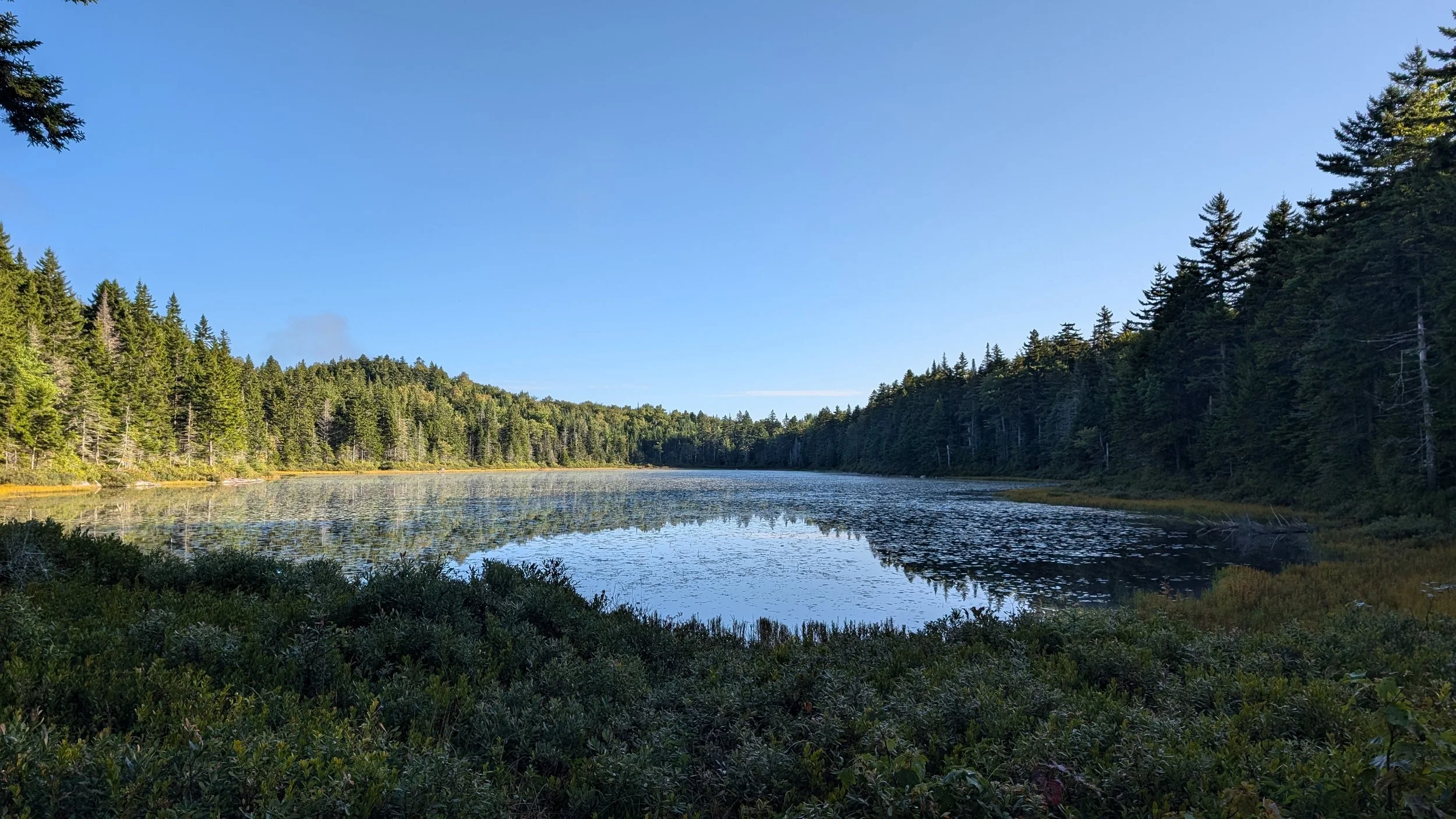
At the time, though, I just decided to break the day up into three parts mentally, rather than thinking about going 15 miles. So I was like, All right, get through 5 miles to site one. Another 5 miles to site two. And then 5 miles to Full Goose. So I struck out and made my way to the first shelter along the way, which was Gentian Pond. And that made me think about gentian root, which is a bittering agent that’s used in a lot of liqueurs and bitters.
So Andrea, if you're reading this, maybe you would like Gentian Pond. Maybe it tastes like Campari or something.

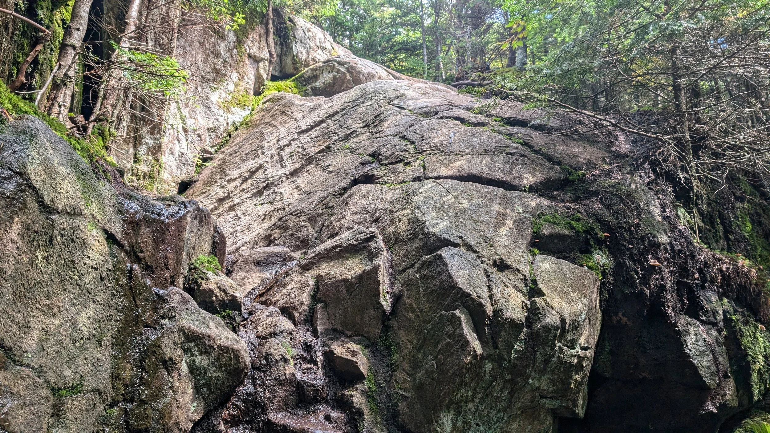
I made it there in less time than I’d expected. It was challenging hiking, but it wasn't anything over the top, so that gave me a bit of confidence about what was to come. I then set out from Gentian Pond over the next 5-mile stretch, which included going over Mount Success. And boy, that was a tough hike. I don't know why Mount Success doesn't show up on more lists of challenging hikes. I mean, it was just straight up, and one of the things that's especially difficult about hiking these mountains in New Hampshire is that it's not just straight up, it's also technical.
And “technical” is just another way of saying that you have to throw your poles to the top of every rock scramble, because you’re going to need your hands and feet to get up it. It ends up being more rock climbing than hiking, and that's just a momentum killer. It takes forever to make any progress. And then if you have to go down one of those sections, you’ve got to throw your poles down ahead of you and turn around backward and sort of climb down. So navigating up and down these rock faces takes about ten times as long as it would to walk or hike the same distance on a normal section of trail. Again, they’re just absolute momentum killers.
I got mostly to the top of Mount Success and bumped into an older gentleman who immediately asked me whether I knew where the site of the DC-3 crash was. Apparently, sometime in the 1950s, a McDonnell Douglas DC-3 plane crashed into the side of Mount Success on its way to Berlin Airport in New Hampshire. I had known nothing about this, but this gentleman was very intent on finding the wreckage. [Wife note: The wreckage is still there, not far from the trail. Here’s a story on the incident.]
He was an interesting fellow. I asked him his name, and he had a very thick New Hampshire accent, so he calls himself New Hampshire Peak Bagger, but it came out more like Nooh Hamp-shy-yah Peeek Bag-gah. I probably stood there for a good 20 minutes while he told me about all his hiking feats in New Hampshire and some other places and then gave me a bit of a history lesson about the DC-3 crash.
Then he started talking about how he was hiking last year — and this was very fortunate for him, within context — and had a heart attack. His widowmaker valve was actually the one that was blocked, but he survived, obviously. The doctors attributed his survival to the fact that he was in good shape from all his hiking. Otherwise, they call it a widowmaker for obvious reasons.
While we were talking, he spotted a day hiker coming, but when I turned around to look, I couldn't see anyone. Apparently, the gentleman has got eagle eyes or something, and he went off on a long diatribe about how he can see things that most people can't. Eventually, the day hiker showed up, and New Hampshire Peak Bagger immediately started asking him whether he knew where the DC-3 wreckage was, and that was my cue to get the heck out of there.
I moved on to the peak of Mount Success and was chatting with some day hikers up there when, of course, Peak Bagger showed up and started asking the day hikers about the DC-3 incident. And just to round out the full profile on this guy, he could have easily been in one of those Pepperidge Farm commercials from the ’80s. He was a funny guy, but I just wasn’t eager to have a lot of connection with him at that point, because my ears would have fallen off from him talking so much.
I had pretty good cell service up on the peak of Mount Success, so before I headed out again, I called the Pine Ellis hostel, which is in Andover, Maine. I was originally thinking about staying there just one night. But I’d seen on their site that they offer slack packing, so I consulted with S. about my options, and she encouraged me to stay there on the 30th and do a slack on the 31st. You know, it didn’t take a lot of convincing, and I’m foreshadowing a bit here, but that proved to be a very, very good decision. But anyway, I was able to make my reservations before I continued on, and I felt pretty good about that.
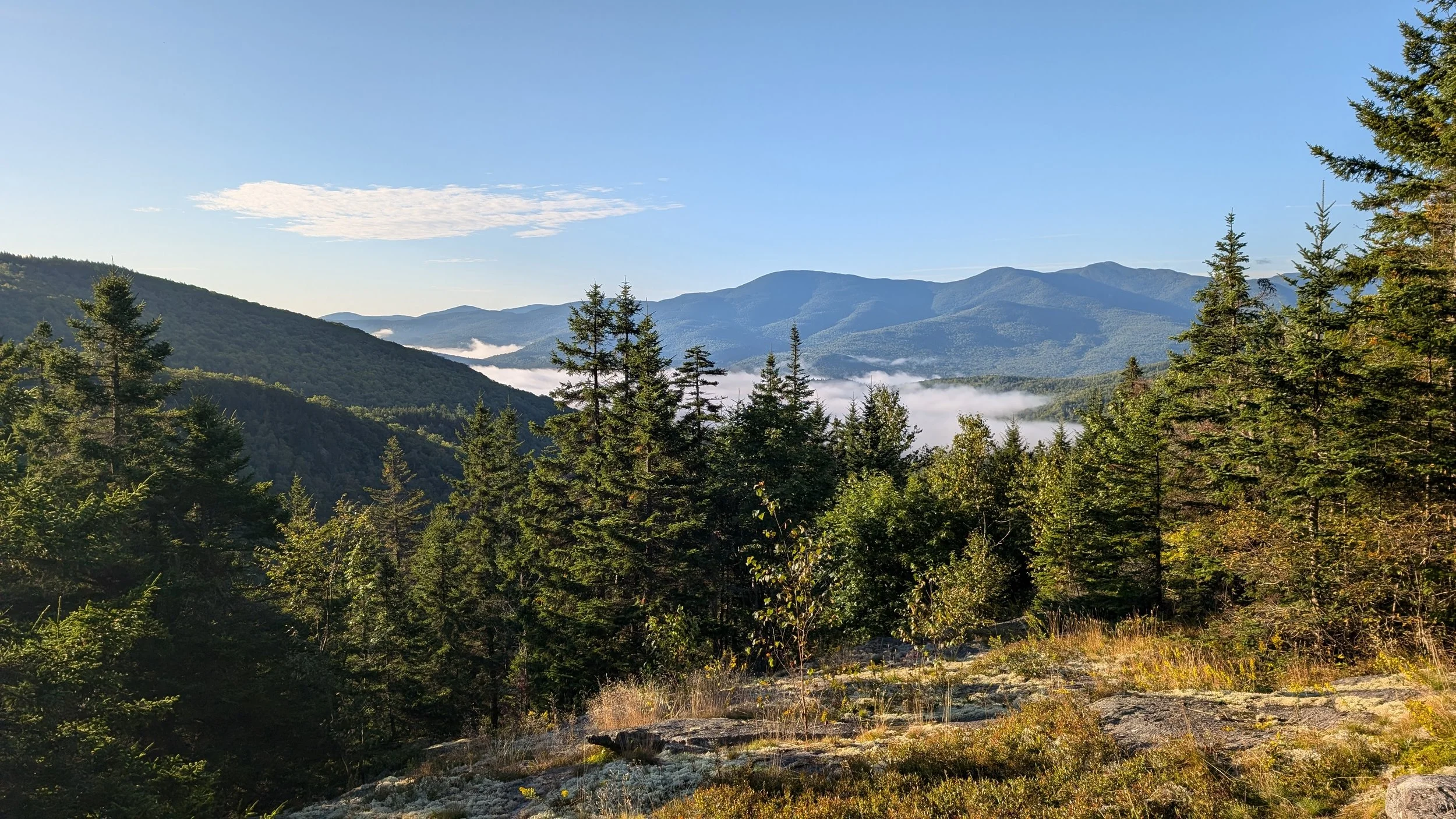
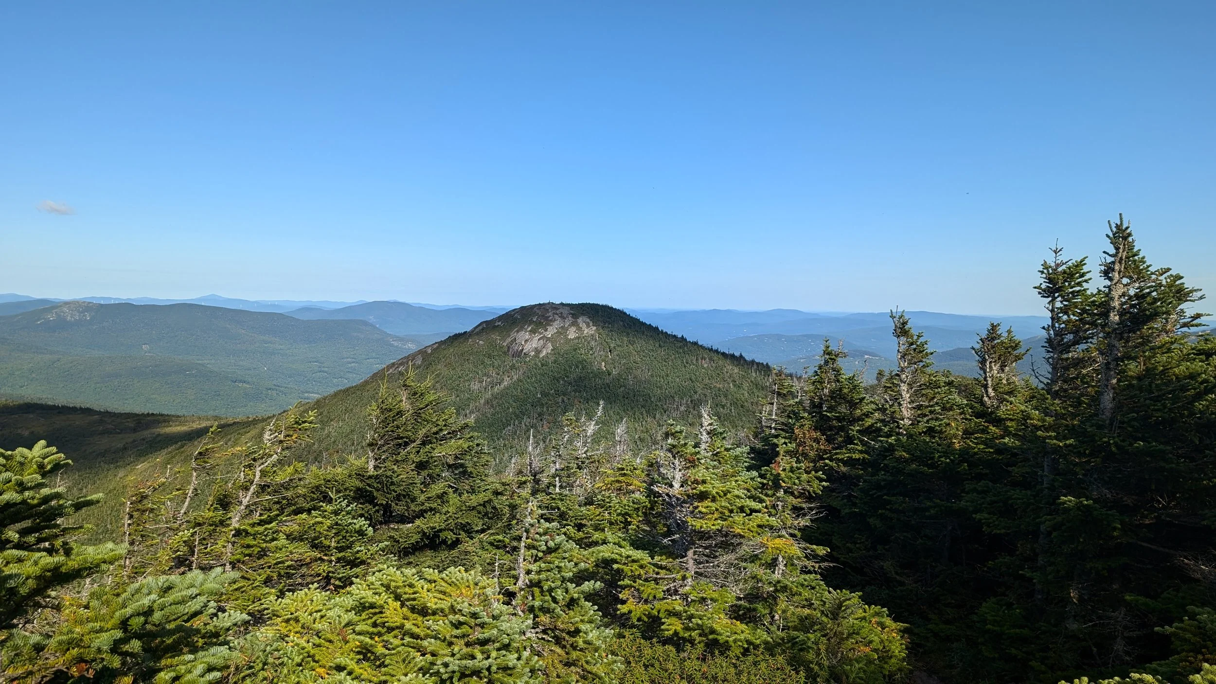
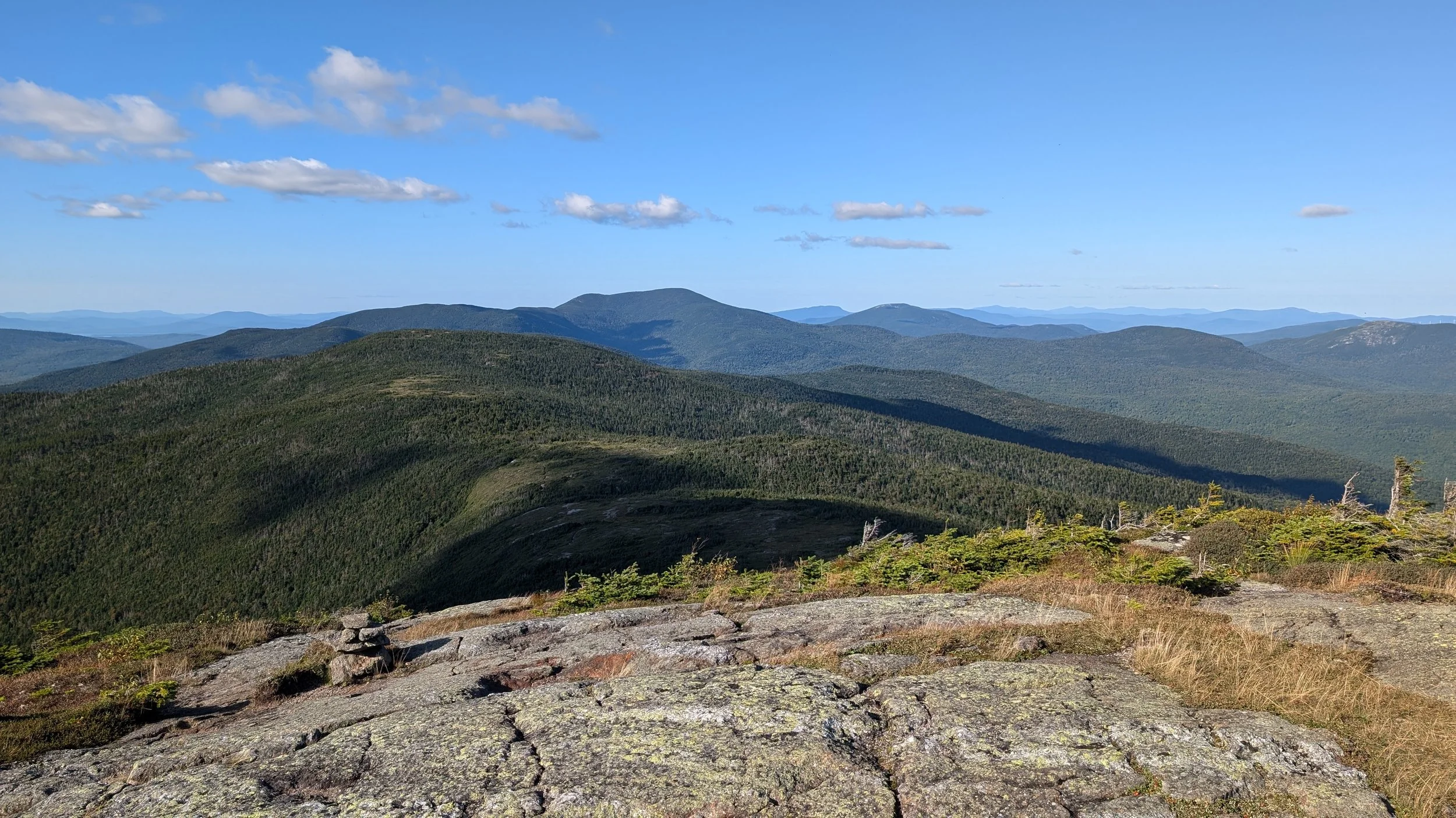
After Mount Success, the next mountain was Goose Eye Mountain, and on some of these peaks in New Hampshire, you can look over and see the next one. And from the top of Success, I could see Goose Eye, and I was like, Please do not let the trail go over that, because it was just this incredibly imposing wall of mountain ahead.
Spoiler alert: The trail went over that.
I got to the peak of Goose Eye by about 5 o'clock, and I had just a spectacular view from up there, but I also knew that I had a punishing descent ahead of me, down to the Full Goose shelter. There was no way around it, and time was a’wastin’, so I just knuckled down and got to Full Goose by about 7 o'clock.

In the end, it took me a little over 11 hours to do 15 miles today. Going from Pinkham Notch to Imp shelter a couple days ago, that was like 10 hours to do 13.5 miles. The next day was more of a reasonable pace, and then today, it took me roughly 11.5 hours to go 15 miles — and I was not resting at all. I was definitely working hard the whole day, and I still couldn’t crack a mile and a half per hour. So that might indicate how difficult this section of the trail is.
On the plus side, when I rolled into the campsite, Groovy and Half Boot were there, so I had managed to catch up to them. It was nice to see them again. Also, I had a tent platform. A guy rolled in shortly after me, named Mule. He’s from Munich, and those of you who know me and S. know that we've been to Munich several times, and we love it over there. So Mule and I had a nice chat about the good breweries in and around Munich, and then we talked about resupply options. So that was fun, but I really need to get to bed now.
I didn't do the best job of thinking ahead, because I just did an incredibly challenging 15 miles, and tomorrow, I have to do what’s considered the hardest day of hiking on the entire AT. I'm going to be going through the infamous Mahoosuc Notch, and after that, the trail goes up Mahoosuc Arm, which is the steepest mile in Maine on the Appalachian Trail. And that's just to start the day! So I've got my work cut out for me tomorrow, after an incredibly difficult day today. I guess we'll see how it goes.